Cebrenia (Gradfeld)

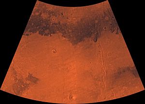
Image of the Cebrenia Gradfeld. The northwest is relatively flat, the southeast contains Hecates Tholus and Phlegra Montes
The Cebrenia - degree field one of the 30 degree field of Mars . They were established by the United States Geological Survey ( USGS ). The number is MC-7, the degree field covers the area from 180 ° to 240 ° west longitude and from 30 ° to 65 ° south latitude . It contains part of Utopia Planitia and Arcadia Planitia .
origin of the name
The name comes from an albedo feature in the area of 50 ° N and 150 ° E on Mars, the area was named after the plains around ancient Troy . The name was confirmed by the International Astronomical Union in 1958 .
geology
The most famous features are the large Mie and Stokes craters , Hecates Tholus , and the Phlegra Montes mountain range . Viking II landed near Mie on September 3, 1973.
Other degree fields
Web links
Commons : Cebrenia - collection of images, videos and audio files
Individual evidence
- ↑ Davies, ME; Batson, RM; Wu, SSC “Geodesy and Cartography” in Kieffer, HH; Jakosky, BM; Snyder, CW; Matthews, MS, Eds. Mars. University of Arizona Press: Tucson, 1992.
- ↑ Cebrenia in the Gazetteer of Planetary Nomenclature of the IAU (WGPSN) / USGS
- ↑ Ezell EK, Ezell LN On Mars: Exploration of the Red Planet. 1958-1988. (Chapter 10) . The NASA History Series. Scientific and Technical Information Branch, 1984. NASA, Washington, DC
- ↑ Oliver Morton: Mapping Mars: Science, Imagination, and the Birth of a World . Picador USA, New York 2002, ISBN 0-312-24551-3 , p. 98.
- ↑ PIA03467: The MGS MOC Wide Angle Map of Mars photojournal.jpl.nasa.gov, February 16, 2002
- ↑ Davies, ME; Batson, RM; Wu, SSC "Geodesy and Cartography" in Kieffer, HH; Jakosky, BM; Snyder, CW; Matthews, MS, Eds. Mars. University of Arizona Press: Tucson, 1992.
