Central Falls
| Central Falls | ||
|---|---|---|
 Broad Street, Central Falls |
||
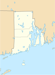
| Location in Rhode Island | ||
|
|
||
| Basic data | ||
| State : | United States | |
| State : | Rhode Island | |
| County : | Providence County | |
| Coordinates : | 41 ° 53 ′ N , 71 ° 24 ′ W | |
| Time zone : | Eastern ( UTC − 5 / −4 ) | |
| Residents : | 19,376 (as of 2010) | |
| Population density : | 6,250.3 inhabitants per km 2 | |
| Area : | 3.3 km 2 (approx. 1 mi 2 ) of which 3.1 km 2 (approx. 1 mi 2 ) are land |
|
| Height : | 27 m | |
| Postal code : | 02863 | |
| Area code : | +1 401 | |
| FIPS : | 44-14140 | |
| GNIS ID : | 1218931 | |
| Website : | www.centralfallsri.us | |
| Mayor : | Charles D. Moreau | |
Central Falls is a city in Providence County , Rhode Island , United States . At the 2010 census , the population was 19,376. At just 1.29 square miles , it is the smallest but most populous city in the smallest state as well as among the most populated cities in the United States. Central Falls takes its name from a waterfall on the nearby Blackstone River . In August 2011, the Central Falls filed for Chapter 9 bankruptcy law.
geography
Central Falls is located between Pawtucket and the cities of Cumberland and Lincoln , it is on the northern edge of the Providence Metropolitan Area , a metropolitan area on the Atlantic coast with 1.5 million inhabitants around Providence , about 40 km southwest of Boston and 200 km northeast of New York . The city is well connected to road traffic, in addition to some state routes in and around the city, the I-95 runs just west of it.
history
The area of the future city was densely forested before 1800 and inhabited by Nipmuck , Wampanoag and Narraganset Indians. The first settlers came from the Smithfield area , the current name of the settlement has existed since 1824.
The city of Central Falls was founded in 1895. Like in Pawtucket, the textile industry dominated the city's economy well into the 20th century, and the Blackstone River provided cheap water power for the city's numerous textile mills. In addition, hammer mills for steel processing existed the cityscape.
There are several National Historic Places in the city , including the Central Falls Mill Historic District , which contains several historic mills, or the South Central Falls Historic District , where several listed houses stand together. The Valley Falls Mill, Office and Bath House ensemble is also a registered monument; in addition to the Valley Falls mill, built in 1855, an associated office building and bath house have been preserved here.
Demographics
According to the 2000 census, there were 6,696 households and 4,359 families in the city. The population density was very high at 6039.8 people per square kilometer. Slightly more than 36% of the population were white and just under 6% were African-Americans , 28% belonged to other ethnic groups. A little over 67% of the population were Hispanics or Latinos . The per capita income was US $ 10,825 and 29% of the population lived below the poverty line .
sons and daughters of the town
- Francis Condon (1891–1965), lawyer and politician
- Charles Risk (1897–1943), politician
- Lincoln Almond (born 1936), politician
Web links
Individual evidence
- ↑ Article "A city declares bankruptcy" in Welt am Sonntag of October 23, 2011, page 38
- ^ City History. ( Memento of the original of July 29, 2009 in the Internet Archive ) Info: The archive link was automatically inserted and not yet checked. Please check the original and archive link according to the instructions and then remove this notice. Central Falls website
