
Kristianopel
| Kristianopel | ||||||
|
||||||
| State : | Sweden | |||||
| Province (län): | Blekinge län | |||||
| Historical Province (landskap): | Blekinge | |||||
| Municipality : | Karlskrona | |||||
| Coordinates : | 56 ° 15 ' N , 16 ° 3' E | |||||
| SCB code : | S2665 | |||||
| Status: | Småort | |||||
| Residents : | 88 (December 31, 2015) | |||||
| Area : | 0.58 km² | |||||
| Population density : | 152 inhabitants / km² | |||||


Kristianopel (formerly Christianopel ) is a small Swedish town with 88 inhabitants (2015) at the southern end of Kalmarsund in the municipality of Karlskrona , which is in the province of Blekinge län . The settlement was a strategically important Danish city on the border with Sweden in the 17th century .
Objects that testify to this importance today are the 3-kilometer-long city wall with bastions based on the Italian model, which were built between 1603 and 1606. The west and south sides of the wall are best preserved. There was also a bulwark , a series of stakes driven into the earth to prevent the enemy from advancing even before the city wall. Today there is a windmill on these piles .
history
Kristianopel was laid out in 1599 by order of the Danish King Christian IV as a replacement for the former city of Avaskär . During the Kalmar War , the city was briefly captured by the Swedish Prince Gustav Adolf in 1611 . The Swedes burned the place down and demolished the old church. The current Trinity Church was built between 1618 and 1624. In 1622 the town charter was transferred from Avaskär and the not far away town of Lyckå to Kristianopel. After the temporary loss of city rights and a comprehensive fortification of the place in 1637, Kristianopel received city rights again in 1648.
The city was thus the easternmost part of a series of fortifications that Denmark built on its border with Sweden at the time. A short time later the place was devastated by Swedish troops. The fact that Blekinge fell to Sweden in the Peace of Roskilde in 1658 also contributed to the decline in the town's importance . Nevertheless, the fortification was repaired in the same year. In 1663 it was decided to demolish the defenses, but in 1670 and 1672 they were renovated again. A year later it was decided to conserve the place.
After Sweden had transferred the garrison of the fortress to Karlshamn in 1676 , Kristianopel was captured by a Danish combat unit on September 25 of the same year. The Danes repaired the half-ruined walls and made the place an important base for the Snapphanar ( parts of the Skåneland population who were loyal to Denmark). On February 22, 1677 Kristianopel was conquered again by Sweden. The fortifications were partially removed as the site was considered dangerous for Sweden's security. In 1678 the order was given that not a single house should remain standing, and the population had to move to the places Ronneby , Växjö and Karlshamn.
In 1952 Kristianopel was incorporated into the rural community of Jämjö (Jämjö landskommun) . With this it has belonged to Karlskrona since 1974.

Aerial view
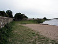
A section of the city wall

Holy Trinity Church

Engraving by Christianopolis from 1729


Web links
Footnotes
- ↑ a b c Statistiska centralbyrån : Småorter 2015, byggnader, areal, överlapp tatorter, coordinater (Excel file)
- ↑ Gemeindechronik Karlskrona ( Memento of the original from May 19, 2014 in the Internet Archive ) Info: The archive link was inserted automatically and has not yet been checked. Please check the original and archive link according to the instructions and then remove this notice. (PDF; 3.7 MB)
Perpetrator: Drottningskär | Fågelmara | Fridlevstad | Gängletorp | Hasslö | Holmsjö | Jämjö | Karlskrona | Kättilsmåla | Nättraby | Nävragöl | Ramdala | Rödeby | Sjuhalla | Skavkulla och Skillingenäs | Spjutsbygd | Sturkö | Torhamn | Tving
Småorter: Alnaryd | Alstugorna | Attanäs och Björkenäs | Berntorp and Björstorp | Björkeryd | Björsmåla, Nättleryd och Yasjö | Bredäng och Konungshamn | Brömsebro | Fäjö | Färmanstorp | Fjärdsjömåla | Gagnekulla och Stubbelycke | Gisslevik | Gredeby | Gullhorna och Orranäs | Hagbo and Björkhaga | Klaraberg | Kristianopel | Målarna | Mältan och Inglatorp | Måstad | Mjöviksstrand | Möcklö | Nabben och Herrgården | Öljersjö | Rosenhill | Rosenholm | Saleboda | Sälleryd | Sjötorp | Södra Gårda och Västra Gårda | Stengöl och Svensgöl norra | Stensnäset | Strömsberg | Torsnäs