
Okavango
|
Okavango Cubango, Okawango, Kavango |
||
 In the Okavango Delta |
||
| Data | ||
| location |
Southern Africa : Angola Botswana Namibia |
|
| River system | Okavango | |
| Headwaters |
Bié highlands in Angola 12 ° 42 ′ 41 ″ S , 16 ° 3 ′ 50 ″ E |
|
| Source height | 1850 m | |
| delta |
Okavango Delta ( endorheic basin) coordinates: 18 ° 50 ′ 41 " S , 16 ° 3 ′ 50" E 18 ° 50 ′ 41 " S , 16 ° 3 ′ 50" E |
|
| Mouth height | 940 m (at the outlet of the delta) | |
| Height difference | 910 m | |
| Bottom slope | 0.49 ‰ | |
| length | 1860 km (including delta to Maun) | |
| Catchment area | 413,550 km² | |
| Discharge at the Mukwe A Eo gauge : 165,000 km² Location: 50 km above the mouth |
MNQ 1950–1998 MQ 1950–1998 Mq 1950–1998 MHQ 1950–1998 HHQ (02/07/1968) |
133 m³ / s 304 m³ / s 1.8 l / (s km²) 701 m³ / s 1473 m³ / s |
| Left tributaries | Cutato, Cuchi, Cacuchi, Cuebe, Cuatir, Chissombo, Cuito | |
| Right tributaries | Bale | |
 Map of the Okavango River Basin |
||
.jpg) Confluence of the Cuito (from above) and |
||
The Okavango, also known as Okawango, Cubango or Kavango , is a 1700-kilometer river in southern Africa .
River course

The river rises as Cubango (also called Kubango ) in the center of Angola on the highlands of Bié and flows from there not to the ocean , but into the desert-like interior of Botswana, with no outflow .
It flows through the highlands south to the border with Namibia . From there it is called the Okavango in its middle reaches and forms the border between Angola and Namibia for about 400 kilometers. Nkurenkuru , the capital of the Kavango-West region, and Rundu , the capital of the Kavango-East region , are on the south bank of the river.
It crosses the elongated, narrow Caprivi Strip of Namibia. Shortly after Andara it forms the Popa Falls with its rapids . Immediately near Andara, he releases part of his water into a canal for a turbine hydropower plant, which was built in the 1980s as part of a project by the Working Group for Development Aid to supply a hospital. Then he reached northwestern Botswana. There the water of the river seeps into the swamps of the (above-ground) drainless Okavango basin in a 15,000 km² and swampy inland delta ( Okavango delta ), which lies in the northeast of the Kalahari ; the size of the delta swells up to 20,000 km² during the rainy season. Therein lies the Moremi Wildlife Reserve (Moremi Wildlife Reserve). In its middle reaches the Okavango is inhabited by crocodiles and hippos . The delta is known for its great biodiversity.
The Okavango gets practically all of its water from Angola. It is fed by a large number of tributaries, which mostly drain very narrow and long, closely spaced catchment areas. The longest tributary is the Cuito with around 920 kilometers .
Amount of water
Due to the lack of rain in winter, the water of the Kubango-Okavango and its tributaries usually only reaches its inland delta with a delay of several months, namely only when it is driven southwards in waves by the floods of the rainy season . Therefore it happens that the middle and lower reaches of the Okavango only flow as a stream , as a sparse trickle or - apart from the lakes that remain in its river basins - fall completely dry. When the rainy season sets in, the Okavango develops into a torrential stream that supplies its swampy delta with plenty of water. On an annual average, it delivers around 10 billion m³ of water into its inland delta without any drainage.
The flow rate was measured in m³ / s at the gauge in Mukwe just before the river merges into the delta (long-term mean since 1949/50).

River length
The length of the Okavango is usually given in reference works as 1,600 or 1,800 kilometers. Both can be regarded as correct: The difficulty in determining its length is the fact that the river in the above-mentioned basin and inland delta on the one hand divides into several river arms, which then end somewhere in the vast swamps . On the other hand, the lengths of these rivers depend heavily on the water supply of the Okavango, which is much more pronounced during the rainy season in summer than in winter with little rain. During the rainy season its water flows normally beyond the borders of this swamp out where he the Lake Ngami and the Boteti the Makgadikgadi Pans fed.
Catchment area
The information about the catchment area varies widely. This is due to the tax base. The total catchment area of the endorheic basin is 721,258 km²; the area that drains directly or indirectly into the Okavango, about 413,550 km² and the portion that actually drains water, about 171,000 km² (plus 15,844 km² delta).
gallery

Okavango Delta
Sign at the Okavango lower course
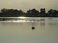
View over the water

In the delta
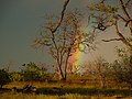
When it rains in the delta


.jpg)
.jpg)

See also
literature
- Peter Johnson, Anthony Bannister, Creina Bond: Okavango. Sea of Land, Land of Water. 8th edition. Struik, Cape Town 1988, ISBN 0-86977-086-1 .
Movies
- Dereck and Beverly Joubert: Natural Wonders Okawango, three-part series, broadcast on Das Erste in May 2020
Web links
- Okavango Basin River Water Commission. (English).
- Okavango pictorial documentation. ( Memento of July 1, 2006 in the Internet Archive ).
- Water Resources Atlas - Watersheds of Africa - A12 Okavango Basin. (PDF; 714 kB; English).