Sechura District
| Sechura District | |||
|---|---|---|---|
 The district of Sechura is located in the south of the province of Sechura (marked in red) |
|||
| Symbols | |||
|
|||
| Basic data | |||
| Country | Peru | ||
| region | Piura | ||
| province | Sechura | ||
| Seat | Sechura | ||
| surface | 5,711.3 km² | ||
| Residents | 44,590 (2017) | ||
| density | 7.8 inhabitants per km² | ||
| ISO 3166-2 | PE-PIU | ||
| Website | munisechura.gob.pe (Spanish) | ||
| politics | |||
| Alcalde Provincial | Justo Eche Morales (2019-2022) |
||
| Political party | Alianza para el Progreso | ||
| Cathedral in Sechura | |||
Coordinates: 5 ° 33 ′ S , 80 ° 49 ′ W
The district of Sechura is located in the province of Sechura in the region of Piura in northwestern Peru . The district has an area of 5711.25 km². In the 2017 census, 44,590 people lived in the district. In 1993 the population was 19,235, in 2007 32,965. The administrative seat is the coastal and provincial capital of Sechura with 33,134 inhabitants (as of 2017).
Geographical location
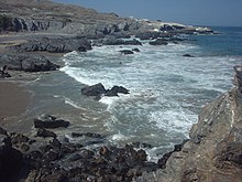
The district of Sechura is located on the Pacific Ocean in the south of the province of Sechura, south of the mouth of the Río Sechura. The district consists mostly of desert. To the west is the Illescas peninsula
The district of Sechura borders in the northwest on the district Vice , in the north on the districts Rinconada Llícuar , Cristo Nos Valga and Catacaos ( province Piura ) and in the southeast on the district Olmos ( province Lambayeque ).
Individual evidence
- ↑ a b Peru: Piura - Provinces & Districts . www.citypopulation.de. Retrieved April 1, 2020.


