Državna cesta D45
| Državna cesta D45 in Croatia | |||||||||||||||||||||||||||||||||||||||||||||||||||||||

|
|||||||||||||||||||||||||||||||||||||||||||||||||||||||
| map | |||||||||||||||||||||||||||||||||||||||||||||||||||||||
| In operation | |||||||||||||||||||||||||||||||||||||||||||||||||||||||
| Basic data | |||||||||||||||||||||||||||||||||||||||||||||||||||||||
| Operator: | Hrvatske ceste doo | ||||||||||||||||||||||||||||||||||||||||||||||||||||||
| Start of the street: | Kutina | ||||||||||||||||||||||||||||||||||||||||||||||||||||||
| End of street: | Veliki Zdenci | ||||||||||||||||||||||||||||||||||||||||||||||||||||||
| Overall length: | 43.6 km | ||||||||||||||||||||||||||||||||||||||||||||||||||||||
| of which in operation: | 43.6 km | ||||||||||||||||||||||||||||||||||||||||||||||||||||||
|
County : |
|||||||||||||||||||||||||||||||||||||||||||||||||||||||
|
Course of the road
|
|||||||||||||||||||||||||||||||||||||||||||||||||||||||
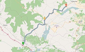
The Državna cesta D45 ( Croatian 'National Road D45' ) is a national road in Croatia , the length of which is 43.6 km. It connects the Slavonian industrial city of Kutina with the village of Veliki Zdenci in the Bjelovar-Bilogora County .
Route
The D45 runs from the industrial town of Kutina via Stupovača , Garešnica , Hercegovac to the village of Veliki Zdenci.
Further traffic connections
The largest junction on the D45 national road is the city of Kutina, where there is a connection to the A3 , which runs from the Slovenian border via Zagreb and Slavonski Brod to the Serbian border and on to Belgrade . There is another small junction in Garešnica , where there is a junction with the D26 , which leads from Vrbovec to Badljevina . At the end of Veliki Zdenci there is a connection to the European road E661 , which leads from the Hungarian border at Bartsch via Virovitica , Daruvar and Pakrac to the Bosnian-Herzegovinian border at Bosanska Gradiška and to the D28, which joins the D10 via Bjelovar in Vrbovec.
Individual evidence
- ↑ 94 July 31, 2014 Odluka o razvrstavanju javnih cesta. In: narodne-novine.nn.hr. Retrieved May 24, 2016 .
