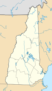
Easton, New Hampshire
| Easton | ||
|---|---|---|
|
Location in New Hampshire
|
||
| Basic data | ||
| Foundation : | 1876 | |
| State : | United States | |
| State : | New Hampshire | |
| County : | Grafton County | |
| Coordinates : | 44 ° 6 ′ N , 71 ° 48 ′ W | |
| Time zone : | Eastern ( UTC − 5 / −4 ) | |
| Residents : | 254 (as of 2010) | |
| Population density : | 3.1 inhabitants per km 2 | |
| Area : | 80.8 km 2 (approx. 31 mi 2 ) of which 80.8 km 2 (approx. 31 mi 2 ) are land |
|
| Height : | 395 m | |
| Postcodes : | 03580 | |
| Area code : | +1 603 | |
| FIPS : | 30-22020 | |
| GNIS ID : | 873586 | |
| Website : | townofeastonnh.org | |
Easton is a town in Grafton County in the US -amerikanischen State New Hampshire .
geography
Easton is at 44 ° 08'46 "north latitude and 71 ° 47'24" west longitude. The capital of the state of Concord is 90 kilometers away in the south. The White Mountain National Forest begins to the east of Easton . The highway Interstate 93 runs just a few kilometers from the city to the east.
History
At the end of the 18th century, the first settlers came to the area and cleared some areas of land in Landaff . Some plots to the east split off from this settlement. The place was called "Easton", as a corruption of the English word for east ("Eastern"), and the foundation took place in 1876.
Demographic data
In 2009 a population of 287 people was determined, which means an increase of 12.1% compared to the year 2000. The median age of the residents in 2009 was 46.9 years, which was relatively high given that the median age of the state of New Hampshire at the same time was 37.1 years.
sons and daughters of the town
- Bode Miller (* 1977), alpine ski racer
- Chelone Miller (1983-2013), professional snowboarder
Individual evidence
Web links
- Homepage of the municipality (English)
- history history
- city-data City data
