El Paso (La Palma)
| El Paso parish | ||
|---|---|---|
| coat of arms | Map of the Canary Islands | |

|
|
|
| Basic data | ||
| Autonomous Community : | Canary Islands | |
| Province : | Santa Cruz de Tenerife | |
| Coordinates | 28 ° 39 ′ N , 17 ° 53 ′ W | |
| Height : | 630 msnm | |
| Area : | 135.92 km² | |
| Residents : | 7,622 (Jan 1, 2019) | |
| Population density : | 56.08 inhabitants / km² | |
| Postal code : | 38750 | |
| Municipality number ( INE ): | 38027 | |
| administration | ||
| Mayoress : | Sergio Javier Rodríguez Fernández ( CC ) | |
| Address of the municipal administration: | Avenida Islas Canarias, 18 | |
| Website : | www.elpaso.es/ayto/ | |
| Location of the municipality | ||

|
||
El Paso has been an independent municipality on the Canary Island of La Palma , which belongs to Spain and belongs to the province of Santa Cruz de Tenerife , since 1837 .
character
El Paso is the largest of the 14 municipalities of La Palma in terms of area. It is located in the center of the island, borders almost every other municipality (with the exception of Tazacorte ) and is the only one with no access to the Atlantic .
In the area of the municipality of El Paso there are predominantly arable land and forests with Canarian pine . The Caldera de Taburiente , a large caldera, belongs to the municipality . This area has been designated as a national park since 1954 .
The majority of the population is rural. The agricultural products include in particular wine, almonds and some types of fruit.
In the Barranco de las Canales , below a cemetery, there are the rock engravings by El Cementerio and La Fajana , which belong to the cultural legacy of the indigenous people, the Benahoaritas .
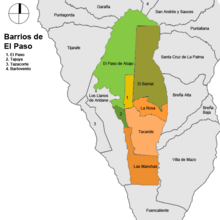
Places of the community
The population figures in brackets are from 2013.
- El Paso (2,219)
- Paso de Abajo (1,338)
- Tajuya (1,397)
- La Rosa (1,209)
- Tacande (774)
- Las Manchas (659)
- El Barrial (332)
Population development
El Paso experienced strong population growth in the 1980s (1981 to 1990: +22 percent), which has since weakened or at times turned into a slight population decline.
|
|
See also
Individual evidence
- ↑ Cifras oficiales de población resultantes de la revisión del Padrón municipal a 1 de enero . Population statistics from the Instituto Nacional de Estadística (population update).
- ↑ http://www.ine.es/nomen2/ficheros.do INEbase (database of the Instituto Nacional de Estadística)


