Chewing earth
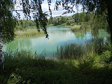
The Erdekaut , also the Erlebnislandschaft Erdekaut since 2008 , is a landscape protection area in the north-eastern Palatinate Forest ( Rhineland-Palatinate ), which was established on the basis of abandoned clay pits and bears the number 07-LSG 3.020. A mining museum is operated in the centrally located historical building of the only surviving Riegelstein mine .
Geographical location
The 64 hectare landscape protection area is about 250 m above sea level. NHN between Eisenberg and Hettenleidelheim in the hilly floodplain south of the Eisbach and mostly east of federal highway 47 . The northern part belongs to Eisenberg, the southern part to Hettenleidelheim. The eastern border roughly coincides with the Schulwiesengraben , which flows a few meters east from the left into the Seltenbach , a right tributary of the Eisbach.
The Erdekaut can be reached via the Autobahn 6 ( Saarbrücken - Mannheim ), Junction 18 Wattenheim , and then the B 47; the Eistalbahn ( Grünstadt - Eiswoog ) stops at Eisenberg station .
history
The landscape protection area was established in 1985. The name derives from the Palatinate name Kaut for "pit" and refers to the previous mining of clay , which can be traced back over centuries. 800 miners were employed at peak times.
In the Middle Ages , the area came into the ownership of the Bishopric of Worms . From 1778 to 1788, the company operated a factory for Dirmstein faience from 1778 to 1788 in Dirmstein , 20 km away , where the Prince-Bishop's summer palace was located, using the raw material obtained from the Erdekaut region . Material was also supplied to the Ottweiler porcelain factory. When, towards the end of the 18th century, the French Revolution spread to the German areas west of the Rhine and these were annexed to France until 1815, the diocese of Worms was secularized and dissolved in 1803; his property was auctioned. After Napoleon's disempowerment , the ownership of the Erdekaut passed to local entrepreneurs. Clay was mined in 30 pits until the 1980s, employing around 600 miners.
Environment and tourism
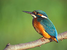
The closure of the clay pits promoted the creation of ponds and open land . Such landform provides exceptional wildlife habitat, particularly certain dragonflies - amphibians - and birds under protection of species are because they are threatened with extinction. In addition to 16 species of orchids and a. Flat-bellied dragonfly , crested newt , common toad and yellow-bellied toad as well as reversible neck , kingfisher and little bittern . The protection of the earth chew in 1985 prevented major human encroachments on the grown biotope .
In order to maintain and maintain the area, the Zweckverband Erdekaut was founded in 2003 as part of a joint project between the Eisenberg and Hettenleidelheim municipalities . On September 15, 2008, he handed over the landscape protection area to the public for use as an adventure landscape, Erdekaut . Guided tours for groups are offered through the Riegelstein mine museum . In the summer of 2010, an international work camp took place in the Erdekaut for the second time ; this time ten young volunteers from several countries laid a new water pipe.
Web links
- Adventure landscape Erdekaut (overview map). (PDF; 1.3 MB) VG Eisenberg, accessed on October 9, 2019 .
Individual evidence
- ↑ a b c d Rheinland-Pfalz-Takt : With the Eistalbahn to the green paradise. Retrieved August 27, 2010 .
- ↑ a b Ecopark "Erdekaut". (No longer available online.) Verbandsgemeinde Eisenberg , archived from the original on June 16, 2010 ; Retrieved August 27, 2010 .
- ↑ Walter Jarosch: Ceramics from Dirmstein . In: Michael Martin (ed.): Dirmstein - nobility, farmers and citizens . Chronicle of the Dirmstein community. Self-published by the Foundation for the Promotion of Palatinate Historical Research , Neustadt an der Weinstrasse 2005, ISBN 3-9808304-6-2 , p. 481-497 .
- ↑ Flat-bellied dragonfly (male). Photo group of the Friends of Nature Rhineland-Palatinate, June 11, 2009, accessed on August 28, 2010 .
- ↑ Planning of networked biotope systems. (No longer available online.) Ministry for Environment and Forests Rhineland-Palatinate, January 1998, p. 95, footnote 184 , formerly in the original ; Retrieved August 28, 2010 . ( Page no longer available , search in web archives )
- ↑ Invitation to the official opening of the Erdekaut adventure landscape. (No longer available online.) Official Journal of the Verbandsgemeinde Hettenleidelheim , September 11, 2008, pp. 1 and 5 , formerly in the original ; Retrieved August 26, 2010 . ( Page no longer available , search in web archives )
- ↑ Work becomes competition . In: Die Rheinpfalz , local edition Unterhaardter Rundschau . Ludwigshafen August 9, 2010.
Coordinates: 49 ° 32 '52.41 " N , 8 ° 4' 28.42" E


