
Hettenleidelheim
| coat of arms | Germany map | |
|---|---|---|

|
Coordinates: 49 ° 32 ' N , 8 ° 4' E |
|
| Basic data | ||
| State : | Rhineland-Palatinate | |
| County : | Bad Dürkheim | |
| Association municipality : | Leiningerland | |
| Height : | 295 m above sea level NHN | |
| Area : | 5.07 km 2 | |
| Residents: | 3073 (Dec. 31, 2019) | |
| Population density : | 606 inhabitants per km 2 | |
| Postal code : | 67310 | |
| Area code : | 06351 | |
| License plate : | DÜW | |
| Community key : | 07 3 32 027 | |
| LOCODE : | DE DH7 | |
| Association administration address: | Industriestrasse 11 67269 Grünstadt |
|
| Website : | ||
| Local Mayor : | Steffen Blaga ( CDU ) | |
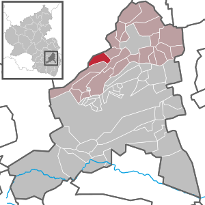
| Location of the local community Hettenleidelheim in the Bad Dürkheim district | ||
  |
||


Hettenleidelheim , called Hettrum in the Palatinate , is a municipality in the Bad Dürkheim district in Rhineland-Palatinate . It belongs to the community of Leiningerland , within which it is the second largest local community in terms of population. According to state planning, Hettenleidelheim is designated as a basic center.
geography
location
Hettenleidelheim is located on the northeastern edge of the Palatinate Forest near its stump forest in the so-called Eisenberg Basin , which in turn is part of the Rheinhessen table and hill country .
Neighboring communities are - clockwise - Eisenberg , Tiefenthal , Neuleiningen and Wattenheim . It is two kilometers to the small town of Eisenberg in the north. Towards Eisenberg is the protected landscape earth Kaut . The community is surrounded by several corridors: To the east lie on the heap and at the Second morning , in the north crows beak , in the northwest in the crutch fields in the southwest In the middle tub and in the west in the rear Be .
Waters
The municipality is located in the area of the watershed between Eisbach and Eckbach , which flow past to the north and south of the town, geologically, Wattenheim is on the older elevated terrace and the younger main terrace of the Eisbach, which, however, runs beyond the municipality marker. The Seltenbach runs east of the settlement area in a south-north direction .
history

Development up to the 18th century
Hettenleidelheim originally consisted of two places: Hitenheim, later Hettenheim, and Luttelheim, later Leidelheim. Both came under the rule of the Ramsen Monastery in the Middle Ages and after its dissolution in 1485 belonged to the Worms Monastery as temporal property ; there they were subordinate to the Dirmstein office . This is still indicated today by the municipal coat of arms derived from the Worms diocese coat of arms. The communal unification of both places - later trading as Hettenleidelheim - under a common village court was ordered in 1556 by the sovereign, Prince-Bishop Dietrich von Bettendorf .
In Hettenheim there was the St. Stephan chapel, a branch of the parish Eisenberg (Palatinate) , and in Leidelheim the Peterskapelle existed as a branch of Wattenheim ( Worms Synodale 1496). From Eisenberg (lordship of Kirchheim-Stauf) and von Wattenheim (lordship of Leiningen ), Lutheran services were held in the two chapels of the Wormsian exclave from 1569 onwards , but the weakened diocese could not defend itself. When in 1624, during the Thirty Years' War , the Catholic party gained the upper hand, both parishes were first re-parished to the Catholic Neuleiningen . In 1705 the place was raised to an independent Catholic parish.
From 1720 to 1724 a new Catholic parish church was built in the Leidelheim district by adding a baroque nave with a tower to the medieval St. Peter's Chapel. The auxiliary bishop of Worms, Johann Baptist Gegg, consecrated this church, consecrated to St. Peter and St. Hubertus, on August 27, 1724; the next day he traded 1700 people in Hettenleidelheim.
Since the 19th century
From 1798 to 1814, when the Palatinate was part of the French Republic (until 1804) and then part of the Napoleonic Empire , the municipality was incorporated into the canton of Grünstadt and was the seat of its own Mairie. In 1815 the place had 560 inhabitants. In the same year it was added to Austria . Just one year later, the place, like the entire Palatinate, changed to the Kingdom of Bavaria . From 1818 to 1862 the community, which during this time was partly run as Hettenheim and Leidelheim , belonged to the Landkommissariat Frankenthal ; from this the district office of Frankenthal emerged. It was not until 1828 that the place name "Hettenleidelheim" was established.

Since the middle of the 19th century, and increasingly since the years around 1870, the mining and, since 1901, the factory utilization of the local highly refractory clay became the main branch of the economy. This industry came to a standstill after World War II. From 1939 Hettenleidelheim was part of the Frankenthal district (Palatinate) . After the Second World War , the place became part of the then newly formed state of Rhineland-Palatinate within the French occupation zone . In the course of the first Rhineland-Palatinate administrative reform , the place moved in 1969 to the newly created district of Bad Dürkheim . Three years later, the place was assigned as the administrative seat of the association of the same name . In 2005, Hettenleidelheim celebrated its 850th anniversary. The community has been part of the Leiningerland community since 2018.
religion
Christianity
Around 1400 Catholic and 850 Protestant Christians are represented in the village, each with a parish. Most of the Protestants arrived in the second half of the 20th century. The Catholic parish of St. Peter with a branch in St. Georg, Tiefenthal, now forms a parish community with Wattenheim, Altleiningen including Höningen and now Carlsberg including Hertlingshausen . The Protestant parish is an independent branch of Wattenheim.
Judaism
The old and new cemeteries , which were occupied from the 18th to the 20th century, with some remarkable tombstones , bear witness to the Jewish community that used to exist in the village, for which the synagogue in neighboring Wattenheim was initially responsible . From the middle of the 19th century there was temporarily a synagogue in the village , but it had been abandoned by the turn of the century due to the small number of parishioners.
politics
Municipal council
The municipal council in Hettenleidelheim consists of 20 council members who were elected in a personalized proportional representation in the local elections on May 26, 2019 , and the honorary local mayor as chairman.
The distribution of seats in the municipal council:
| year | SPD | CDU | FWG | total |
|---|---|---|---|---|
| 2019 | 6th | 10 | 4th | 20 seats |
| 2014 | 9 | 9 | 2 | 20 seats |
| 2009 | 9 | 8th | 3 | 20 seats |
| 2004 | 9 | 9 | 2 | 20 seats |
- FWG = Free Voting Group Hettenleidelheim e. V.
mayor
The local mayor is Steffen Blaga from the CDU. In the election on October 30, 2016, it received 69.1 percent of the vote. The turnout was 57.5 percent. In the regular local elections on May 26, 2019, he was confirmed with a share of the vote of 83.96 percent. Blaga's predecessor in office was Joachim Blum from the SPD; before that, Jakob Dormann - also a member of the SPD - held the office from 1992 to 2009.
coat of arms
|
|
Blazon : "In black, a slanted silver key with a downward facing beard,accompanied by a floating golden St. Andrew's crossat the bottom right " |
| Crest Reason: It was in 1979 by the county government Neustadt approved and goes back to a seal of 1758. The key symbolizes the Bishopric of Worms , whose patron St. Peter was |
Parish partnership
A partnership has been maintained with the French Blanzy in Burgundy since 1978.
Culture and sights
Buildings
Cultural monuments


The old and the new Jewish cemetery are designated as monument zones. The former is located in the immediate vicinity of the warrior's grove and was created in the 18th century. His successor was laid out on the road to Tiefenthal in the 19th century. There are also a total of 25 individual monuments, including the following objects:
Catholic Church - The Catholic Church is in the district Leidel home and was built from 1720 to 1724, 1898 to 1901 she was an architect Wilhelm Schulte I. expanded. It has two remarkable stone baroque altars from the time it was built.
Station - The old station is a dark sandstone structure that was built towards the end of the 19th century.
Kriegerhain - The Kriegerhain in the lower village of Hettenheim preserves various monuments and remarkable gravestones from the 17th century. The site served as the churchyard of the medieval Hettenheim Stephanus chapel, which was abandoned in the period from 1720 to 1724 in favor of the then newly built parish church in Leidelheim.
Old school - The old school , built in the middle of the 19th century, with a crenellated tower, which now serves as the club's house , is unusual .
Other structures
Another important building is the spacious community festival hall, which was built in prestressed concrete by the gymnastics club Gut Heil in the 1920s and renovated around 2000. There is also the Karl Blum local history museum and archive , which provides information about the history of the site and the way in which it was extracted. The stone circle of Hettenleidelheim is also located within the municipality .
nature
Although it is only on the edge of the Palatinate Forest, the entire area of the municipality is part of the Palatinate Forest Nature Park .
societies
The local football club VfR Hettenleidelheim and the volleyball club ASV Hettenleidelheim exist .
music
The St. Peter Catholic Church Choir, the Frohsinn Choir and the Glück Auf Bergmanns Wind Orchestra deal with the performance of music .
Regular events
On Whit Monday there is a forest festival in Birkenschlag. The Kerwe always takes place on the last weekend in August.
Economy and Infrastructure
economy
Hettenleidelheim used to live off clay mining. The products of the Dirmsteiner Fayencen and the earthenware factory in Grünstadt were created from the substances developed in this way . This branch of the economy has since been discontinued. The Palatinate Tonwerke Hagenburger and Schwalb were once located on site. Hettenleidelheim and its two places of origin were entitled to buy timber in the nearby stump forest.
traffic

Federal highway 47 runs in a large arc along the eastern edge of the settlement area . From this the state road 453 branches off , which leads in an easterly direction to Frankenthal . The district road 35 runs through the middle of the village, which leads to Ramsen on the other side of the district and there becomes district road 74 . The place is close to the Autobahn 6 , which runs for around one kilometer through the southeast of the district; it can be reached via the Wattenheim junction one kilometer away .
From 1894 to 1990 there was a rail connection to Ebertsheim , which mainly served the local clay pits; this branched off from the Eistalbahn Grünstadt - Enkenbach , opened in 1876 and 1932 ; passenger transport was offered from 1895 and always played a subordinate role, so that it was discontinued in 1954. Freight traffic lasted until 1987; three years later the line was dismantled. The railway line to Grünstadt can now be reached by bus that goes to Eisenberg (Pfalz) train station .
Public facilities
From 1972 to 2017, Hettenleidelheim housed the administrative headquarters of the Hettenleidelheim Association .
education
The community has its own primary school , and it is possible to attend secondary schools in neighboring towns.
Personalities
Honorary citizen
- Karl Blum (1906–2002), local history researcher, made a contribution to the processing of local history.
Sons and daughters of the church
- Jakob Schwalb (1872–1934), Catholic priest, dean in Göllheim, was a victim of the Nazi regime.
- Nikolaus Osterroth (1875–1933), politician (SPD), was a member of the Weimar National Assembly.
- Jack Osterroth (1902–1981), painter
- Georg Schmidt (1902–1962), politician (center), member of the North Rhine-Westphalian state parliament
- Manfred Stumpf (1930–2010), politician (SPD)
People who lived and worked on site
- Manfred Holz (1938–2014), physicist, grew up on site
- Werner Holz (1948–1991), painter and graphic artist, grew up on site
- Joseph Sales Miltenberger (1777–1854), Provost and Vicar General of the Diocese of Speyer , was a Catholic pastor in Hettenleidelheim from 1811 to 1815 and donated a monstrance here in 1850 .
- Theo Rörig (* 1940), sculptor, designed the sanctuary of the Catholic Church.
- Norbert Sund (* 1959), volleyball player, played for ASV Hettenleidelheim from 1973 to 1977 .
- Arno Wolf (1959–2013), soccer player, played for VfR Hettenleidelheim until 1976
- Wolfgang Wolf (* 1957), soccer player, played for VfR Hettenleidelheim until 1976
literature
- Literature about Hettenleidelheim in the Rhineland-Palatinate state bibliography
Web links
Individual evidence
- ↑ State Statistical Office of Rhineland-Palatinate - population status 2019, districts, communities, association communities ( help on this ).
- ↑ State Statistical Office Rhineland-Palatinate - regional data
- ^ On the association under Prince-Bishop Dietrich von Bettendorf and on the history of religion ( Memento from December 1, 2015 in the Internet Archive )
- ↑ kreis-bad-duerkheim.de: local church Hettenleidelheim . Archived from the original on April 1, 2016 ; accessed on February 12, 2018 .
- ↑ KommWis, as of December 31, 2013
- ↑ Information on the Jewish history of Hettenleidelheim
- ^ The Regional Returning Officer RLP: Local council election 2019 Hettenleidelheim. Retrieved October 13, 2019 .
- ^ The Regional Returning Officer Rhineland-Palatinate: Municipal elections 2014, city and municipal council elections.
- ↑ jös (author abbreviation): Hettenleidelheim: Steffen Blaga is the new local mayor. In: The Rhine Palatinate . October 30, 2016. Retrieved January 19, 2017 .
- ^ The Regional Returning Officer RLP: direct elections 2019. see Leiningerland, Verbandsgemeinde, eleventh result line. Retrieved October 13, 2019 .
- ^ Karl Heinz Debus: The great book of arms of the Palatinate. Neustadt an der Weinstrasse 1988, ISBN 3-9801574-2-3 .
- ^ Heimatmuseum-und-Archiv-Karl-Blum-Hettenleidelheim. In: deutscheweinstrasse-pfalz.de. Retrieved April 25, 2019 .

Altleiningen | Bad Dürkheim | Battenberg (Palatinate) | Bissersheim | Bobenheim am Berg | Bockenheim an der Weinstrasse | Carlsberg | Dackenheim | Deidesheim | Dirmstein | Ebertsheim | Ellerstadt | Elmstein | Erpolzheim | Esthal | Forest on the Wine Route | Frankeneck | Freinsheim | Friedelsheim | Gerolsheim | Gönnheim | Grosskarlbach | Grünstadt | Hassloch | Herxheim am Berg | Hettenleidelheim | Kallstadt | Children's home | Kirchheim an der Weinstrasse | Kleinkarlbach | Lambrecht (Palatinate) | Laumersheim | Lindenberg | Meckenheim | Mertesheim | Neidenfels | Neuleiningen | Niederkirchen near Deidesheim | Obersülzen | Obrigheim (Palatinate) | Quirnheim | Ruppertsberg | Tiefenthal | Wachenheim an der Weinstrasse | Wattenheim | Weidenthal | Weisenheim am Berg | Weisenheim am Sand