
Bissersheim
| coat of arms | Germany map | |
|---|---|---|

|
Coordinates: 49 ° 32 ' N , 8 ° 12' E |
|
| Basic data | ||
| State : | Rhineland-Palatinate | |
| County : | Bad Dürkheim | |
| Association municipality : | Leiningerland | |
| Height : | 141 m above sea level NHN | |
| Area : | 2.57 km 2 | |
| Residents: | 454 (Dec. 31, 2019) | |
| Population density : | 177 inhabitants per km 2 | |
| Postal code : | 67281 | |
| Area code : | 06359 | |
| License plate : | DÜW | |
| Community key : | 07 3 32 004 | |
| LOCODE : | DE SSH | |
| Association administration address: | Industriestrasse 11 67269 Grünstadt |
|
| Website : | ||
| Local Mayor : | Elmar Reichert | |
| Location of the local community Bissersheim in the Bad Dürkheim district | ||
  |
||

Bissersheim is a local community in the Palatinate district of Bad Dürkheim , which belongs to the community of Leiningerland . The place is about 16 km northwest of Ludwigshafen am Rhein on the edge of the European metropolitan region Rhine-Neckar .
Geography and geology
Bissersheim is at 141 m above sea level near the northern end of the German Wine Route and on the western edge of the Upper Rhine Graben . To the west rises the Haardt 1) as the eastern edge of the Palatinate Forest , in the east the 35 km wide Upper Rhine Plain extends . The Eckbach , which is regionally also called the Eck and flows into the Rhine near Worms, flows through the village in an easterly direction .
history
The place was first mentioned in the year 774 as Bizzirichesheim . The Rhine Franconian Duke Nanthar and his wife also donated their property here to the Münsterdreisen monastery that they had founded . King Conrad III. confirmed this foundation in 1144.
From 1816 on, the evangelical parish village of Bissersheim belonged to the Kingdom of Bavaria and was part of the canton of Grünstadt in the Rhine district . In 1840 the place had 60 houses and 378 inhabitants, including 43 Jews. It was the seat of a mayor's office.
From 1939 on, Bissersheim belonged to the Frankenthal (Pfalz) district until it was dissolved in 1969. After moving to the new Bad Dürkheim district in the same year , Bissersheim was assigned to the also newly formed community of Grünstadt-Land in 1972. In 2018 the association was assigned to the community of Leiningerland .
population
The population of Bissersheim has developed as follows, the values from 1871 to 1987 are based on censuses:
|
|
politics
Municipal council
The local council in Bissersheim consists of eight council members, who in the local elections on May 26, 2019 in a majority vote were elected, and the honorary mayor as chairman.
mayor
Elmar Reichert is the local mayor of Bissersheim. There were no candidates in the local elections on May 26, 2019. Reichert was elected by the local council and is the successor to Heinrich Krauss, who was no longer a candidate for this office (now a councilor).
coat of arms
The municipal coat of arms shows St. Margaret of Antioch , under whose patronage - together with St. Blasius - the Bissersheim parish church of St. Blasius and St. Margaretha stands.
Sights and culture

Parish church

Village square
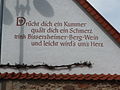
Motto for wine


Economy and Infrastructure
The municipality is a wine-growing village in the Palatinate wine-growing region and looks back on a long wine-growing tradition.
Sons and daughters of the church
- Abraham Kuhn (1838–1900), professor of medicine at the University of Strasbourg
literature
- Klaus Lux (Ed.): Bissersheim . Local history. Local community Bissersheim, Bissersheim 2000.
- Literature about Bissersheim in the Rhineland-Palatinate state bibliography .
Web links
- Local community Bissersheim on the website of the Verbandsgemeinde Grünstadt-Land
Individual evidence
- ↑ a b State Statistical Office of Rhineland-Palatinate - population status 2019, districts, municipalities, association communities ( help on this ).
- ↑ Michael Frey : Attempt of a geographical-historical-statistical description of the court district of Frankenthal in the royal. Bayer. Rheinkkreis , Neidhard, 1836, p. 329 ( Google Books ).
- ^ Max Siebert: The Kingdom of Bavaria topographically and statistically in lexicographical and tabular form , Verlag Georg Franz, Munich 1840. S. 158 ( Google Books ).
- ↑ State Statistical Office Rhineland-Palatinate - regional data.
- ^ The Regional Returning Officer RLP: Municipal Council Election 2019 Bissersheim. Retrieved October 12, 2019 .
- ^ The Regional Returning Officer RLP: direct elections 2019. see Leiningerland, Verbandsgemeinde, third line of results. Retrieved October 12, 2019 .
- ↑ Joerg Schifferstein: Continuity chosen. Die Rheinpfalz, May 28, 2019, accessed on October 12, 2019 .
- ^ Bissersheim local community: Bissersheim local council. Retrieved October 12, 2019 .

Altleiningen | Bad Dürkheim | Battenberg (Palatinate) | Bissersheim | Bobenheim am Berg | Bockenheim an der Weinstrasse | Carlsberg | Dackenheim | Deidesheim | Dirmstein | Ebertsheim | Ellerstadt | Elmstein | Erpolzheim | Esthal | Forest on the Wine Route | Frankeneck | Freinsheim | Friedelsheim | Gerolsheim | Gönnheim | Grosskarlbach | Grünstadt | Hassloch | Herxheim am Berg | Hettenleidelheim | Kallstadt | Children's home | Kirchheim an der Weinstrasse | Kleinkarlbach | Lambrecht (Palatinate) | Laumersheim | Lindenberg | Meckenheim | Mertesheim | Neidenfels | Neuleiningen | Niederkirchen near Deidesheim | Obersülzen | Obrigheim (Palatinate) | Quirnheim | Ruppertsberg | Tiefenthal | Wachenheim an der Weinstrasse | Wattenheim | Weidenthal | Weisenheim am Berg | Weisenheim am Sand