Tiefenthal (Palatinate)
| coat of arms | Germany map | |
|---|---|---|

|
Coordinates: 49 ° 32 ' N , 8 ° 6' E |
|
| Basic data | ||
| State : | Rhineland-Palatinate | |
| County : | Bad Dürkheim | |
| Association municipality : | Leiningerland | |
| Height : | 290 m above sea level NHN | |
| Area : | 4.21 km 2 | |
| Residents: | 844 (Dec. 31, 2019) | |
| Population density : | 200 inhabitants per km 2 | |
| Postal code : | 67311 | |
| Area code : | 06351 | |
| License plate : | DÜW | |
| Community key : | 07 3 32 044 | |
| Association administration address: | Industriestrasse 11 67269 Grünstadt |
|
| Website : | ||
| Local Mayor : | Edwin Gaub ( CDU ) | |
| Location of the community of Tiefenthal in the Bad Dürkheim district | ||
Tiefenthal is a municipality in the Bad Dürkheim district in Rhineland-Palatinate . It belongs to the community of Leiningerland .
Geographical location
The community is located in a small valley depression with a northerly slope between the Eis- and Eckbachtal in the Palatinate in the southeast of the Eisenberg basin . The Seltenbach forms the north-western boundary of the district; from the right he takes up the ditch . In addition, the municipality mountain corridor is partly on the municipality of Tiefenthal. Neighboring communities are - clockwise - Ebertsheim , Grünstadt , Neuleiningen , Hettenleidelheim and Eisenberg .
history
In 1318 the place was first mentioned as Dyfendal . It seems here a Marian sanctuary have found that 1,330 of the Wormser bishop and in 1380 by the papal legate , Cardinal Pileus de Prato each one drain was awarded. On June 24, 1362 the Counts Friedrich the Elder and Friedrich the Younger of Leiningen donated two perpetual masses on the St. Mary's and St. George's altar there, because of the “great Genade and Aplaz that can be found in the Godeshuse of Our Dear Frauwen in Dyefendal behind the Nuwenliningen. ” This church stood on the site of today's Protestant parish church. In the new, Catholic branch church of St. George, there is a large, Gothic wooden relief of St. George , with a representation of a castle, which probably comes from the George altar of the old pilgrimage church.
At the Neuleiningen cemetery is the executioner's cross , donated in 1703 by the count executioner Servacius Westheim, who lived in Tiefenthal , with a corresponding inscription.
From 1798 to 1814, when the Palatinate was part of the French Republic (until 1804) and then part of the Napoleonic Empire , Tieffenthal was - as the spelling at the time - incorporated into the canton of Grünstadt and the seat of its own mairie. In 1815 the village was added to Austria after the Congress of Vienna . Just one year later, like the entire Palatinate, it moved to the Kingdom of Bavaria . From 1818 to 1862 Tiefenthal belonged to the Landkommissariat Frankenthal ; from this the district office of Frankenthal emerged.
From 1939 the community was part of the Frankenthal (Palatinate) district . After the Second World War , the place became part of the then newly formed state of Rhineland-Palatinate within the French occupation zone . In the course of the first Rhineland-Palatinate administrative reform , the place moved to the newly created district of Bad Dürkheim . Three years later it became part of the also newly created Verbandsgemeinde Hettenleidelheim . In 2018 the association was assigned to the community of Leiningerland .
religion
In 2013, 40.8 percent of the population were Protestant and 33.0 percent Catholic. The rest belonged to another religion or were non-denominational.
politics
Municipal council
The municipal council in Tiefenthal consists of twelve council members, who were elected in the local elections on May 26, 2019 in a personalized proportional representation, and the honorary local mayor as chairman.
The distribution of seats in the municipal council:
| choice | SPD | CDU | WGT | total |
|---|---|---|---|---|
| 2019 | 3 | 5 | 4th | 12 seats |
| 2014 | 3 | 6th | 3 | 12 seats |
| 2009 | 3 | 5 | 4th | 12 seats |
| 2004 | 2 | 5 | 5 | 12 seats |
mayor
The local mayor is Edwin Gaub (CDU). In the direct election on May 26, 2019, he was confirmed in his office with 78.10% of the votes.
coat of arms
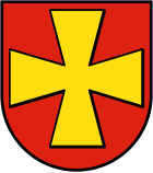
| Blazon : "A golden paw cross in red." | |
| Foundation of the coat of arms: It was approved by the Neustadt district government in 1983 and goes back to a seal from 1724. It is borrowed from the coat of arms of the Counts of Leiningen-Westerburg , to which Tiefenthal belonged. |
Culture
Cultural monuments
There are a total of nine objects on site that are listed .
nature
There are three natural monuments in the municipality .
societies
The fistball club TSG Tiefenthal exists locally , whose women's team is currently represented in the 2nd Bundesliga fistball .
Economy and Infrastructure
economy
The Tiefenthal wind turbines have existed on site since 2001 .
traffic
Landesstrasse 453 runs through Tiefenthal . In the middle of the village, the district road 36 branches off from this , which connects the hamlet of Nackterhof belonging to Neuleiningen . A few kilometers away is the Wattenheim junction of the A 6 motorway .
Historically, the Ebertsheim – Hettenleidelheim railway branching off from the Eistalbahn connected the place with Grünstadt in terms of rail technology ; the station was on the north-western edge of the district far away from the settlement area. As early as 1954, passenger traffic came to a standstill.
Personalities
Sons and daughters of the church
- Jakob von Fitting (1831–1898), President of the Higher Regional Court, ennobled, Imperial Councilor of the Crown of Bavaria
- Philipp Schreiner (1846–1914) scientist and politician (NLP), member of the Reichstag
- Wolfgang Wolf (* 1957), former soccer coach of 1. FC Kaiserslautern
- Jürgen Hufen , sled dog athlete
People who worked on site
- Johann Adam Baum , 1792/93 member of the Rhine-German National Convention
- Veronika and Wolfgang Thomeczek , holders of the Order of Merit of the State of Rhineland-Palatinate since 2018
literature
- Literature about Tiefenthal in the Rhineland-Palatinate state bibliography
Web links
Individual evidence
- ↑ State Statistical Office of Rhineland-Palatinate - population status 2019, districts, communities, association communities ( help on this ).
- ^ State Office for the Preservation of Monuments: Die Kunstdenkmäler von Bayern , Administrative Region Palatinate, VIII. City and District Frankenthal, Oldenbourg Verlag, Munich, 1939, page 474
- ^ Franz Xaver Glasschröder : New documents on the Palatinate Church History in the Middle Ages , Publishing House of the Palatinate Society for the Advancement of Science, Speyer, 1930, pages 159 u. 160, document regist No. 252
- ^ Reclam's Art Guide of Germany , Volume 6 (Rhineland-Palatinate, Saarland), 1980, page 449, ISBN 3-15-010286-3 ; (Detail scan)
- ↑ KommWis, as of December 31, 2013
- ^ The Regional Returning Officer RLP: City Council Election 2019 Tiefenthal. Retrieved October 14, 2019 .
- ^ The Regional Returning Officer Rhineland-Palatinate: Municipal elections 2014, city and municipal council elections
- ^ The regional returning officer RLP: direct elections 2019. see Leiningerland, Verbandsgemeinde, 21st line of results. Retrieved October 14, 2019 .
- ^ Karl Heinz Debus: The great book of arms of the Palatinate. Neustadt an der Weinstrasse 1988, ISBN 3-9801574-2-3 .


