
Kirchheim an der Weinstrasse
| coat of arms | Germany map | |
|---|---|---|

|
Coordinates: 49 ° 32 ' N , 8 ° 11' E |
|
| Basic data | ||
| State : | Rhineland-Palatinate | |
| County : | Bad Dürkheim | |
| Association municipality : | Leiningerland | |
| Height : | 145 m above sea level NHN | |
| Area : | 8.98 km 2 | |
| Residents: | 1919 (Dec. 31, 2019) | |
| Population density : | 214 inhabitants per km 2 | |
| Postal code : | 67281 | |
| Area code : | 06359 | |
| License plate : | DÜW | |
| Community key : | 07 3 32 030 | |
| Association administration address: | Industriestrasse 11 67269 Grünstadt |
|
| Website : | ||
| Local Mayor : | Kay Kronemayer ( FWG ) | |
| Location of the local community Kirchheim an der Weinstrasse in the Bad Dürkheim district | ||
  |
||

Kirchheim an der Weinstraße is a local community in the Palatinate district of Bad Dürkheim , which belongs to the Leiningerland community, within which it is the sixth largest local community in terms of population. The place is about 17 km northwest of Ludwigshafen am Rhein on the edge of the European metropolitan region Rhine-Neckar . The community was called Kirchheim an der Eck until 1952 .
geography
location

Kirchheim is just under 150 m above sea level. NHN Höhe near the northern end of the German Wine Route on the western edge of the Rhine plain and borders in the south on the Freinsheim community . To the west, the Leininger Sporn rises on the edge of the Palatinate Forest as a northern continuation of the Haardt ; About 12 km southwest of the residential area, the community in the source area of the Isenach has a forest area of about two square kilometers. The 35 km wide Upper Rhine Plain extends to the east . Neighboring communities in Kirchheim clockwise are the small town Grünstadt in the north and the villages Obersülzen , Großkarlbach , Bissersheim in the east, Dackenheim in the south, Weisenheim am Berg , Bobenheim am Berg and Kleinkarlbach in the west.
Elevations and waters
The northern flank of the 190.8 meter high Orlenberg on the border with Bissersheim lies in the northeast of the municipality marker. The Eckbach , which is regionally also called the Eck and flows into the Rhine near Worms, flows through the village in an easterly direction . At the northern edge of the municipality the Eckbach flows from the left to the almost one kilometer long Seebergraben (also called Schlossbach ) .
history
Development until 1900
Below in the floodplain of the Eckbach was the nucleus of the place, which initially spread up on the right, southern bank. Kirchheim was first mentioned in 764 AD. Historical finds, however, indicate settlement as early as the Bronze Age .
In the High Middle Ages Kirchheim was a fiefdom of the Weißenburg monastery until it fell partially to the Leininger family in 1250 and then completely in 1304 . In the 15th century the village was temporarily owned by the Electors of the Palatinate . The noble family of the Kranich von Kirchheim named themselves after the village.
In the early modern period it experienced several catastrophes: in 1661 a plague epidemic broke out, in 1690 the troops of Ludwig XIV destroyed Kirchheim. In 1757 the Ruhr raged and during the French Revolution there was further looting and destruction. In 1793, a castle built by the Counts of Leiningen in 1785 was destroyed. Until the end of the 18th century the place belonged to Leiningen-Westerburg . In 1795 a battle took place on site in which the Austro-Hungarian hussar regiment "Wilhelm II. King of Württemberg" No. 6 was involved.
From 1798 to 1814, when the Palatinate was part of the French Republic (until 1804) and then part of the Napoleonic Empire , Kirchheim an der Eck - as the place name was at the time - was incorporated into the canton of Grünstadt and had its own Mairie . In 1815 the place had a total of 924 inhabitants. In the same year it was added to Austria . Just one year later, the place, like the entire Palatinate, changed to the Kingdom of Bavaria . From 1818 to 1862 the community belonged to the Landkommissariat Frankenthal ; from this the district office of Frankenthal emerged. The 19th century was marked by the emigration of many Kirchheim residents and the resulting sharp decline in population.
Since the 20th century
From 1939 Kirchheim was part of the Frankenthal (Palatinate) district . After the Second World War , the place became part of the then newly formed state of Rhineland-Palatinate within the French occupation zone . The first half of the 20th century brought numerous war casualties, 58 of them in the First and 54 in the Second World War .
In 1952 the community was renamed Kirchheim an der Weinstrasse . As part of the first Rhineland-Palatinate administrative reform , she moved to the newly created Bad Dürkheim district in 1969 . Three years later it was assigned to the also newly formed community of Grünstadt-Land , which was merged into the community of Leiningerland in 2018.
In 2006 the NPD tried to open a training center in Kirchheim. For this purpose, the former Grafliche Leininger Mühle , whose farm building had served as a restaurant for some time, was to be acquired and converted. The purchase of the property failed because the community of Grünstadt-Land arranged for it to be placed under a preservation order, which was linked to a ban on changes . On 13./14. May 2006 the farm building was badly damaged by an unsolved arson . The suspected perpetrators were, on the one hand, militant NPD opponents and, on the other hand, the party itself, which wanted to lower the purchase price. In the spring of 2009, the farm building, which was not listed, was demolished; the rest of the facility is to be renovated.
religion
Since the end of the 19th century, Kirchheim had a synagogue that survived the Nazi era, but is now used as a residential building. In 2007, 45.9 percent of the population were Protestant and 26.9 percent Catholic. The rest belonged to another religion or were non-denominational.
politics
Municipal council
The municipal council in Kirchheim consists of 16 council members, who were elected in the local elections on May 26, 2019 in a personalized proportional representation, and the honorary local mayor as chairman.
The distribution of seats in the municipal council:
| choice | SPD | CDU | FWG | KL | total |
|---|---|---|---|---|---|
| 2019 | 4th | 4th | 7th | 1 | 16 seats |
| 2014 | 4th | 7th | 3 | 2 | 16 seats |
| 2009 | 5 | 6th | 3 | 2 | 16 seats |
| 2004 | 5 | 5 | 3 | 3 | 16 seats |
- FWG = Free Voter Group Kirchheim e. V.
- KL = voter group Kirchheimer list e. V.
mayor
Local mayor is Kay Kronemayer (FWG). In a runoff election on June 16, 2019, he prevailed against his predecessor Robert Brunner (CDU) with a share of 65.19% of the vote, after none of the original three candidates had achieved a sufficient majority in the local election on May 26, 2019.
coat of arms
The blazon of the coat of arms reads: "Split of silver and blue, on the right a black St. Andrew's cross, on the left a red-covered silver church with a gold cross on a green background".
It was approved by Ministerial Resolution in Munich in 1904 and is based on a seal from 1509. The church refers talking on the place name. The cross commemorates St. Andreas , the patron of the parish church.
Sights and culture
Buildings
The town center, consisting of Hintergasse 2, Kleinkarlbacher Str. 2 and Weinstrasse Nord 1–43, is designated as a monument zone . For the municipal area, 30 buildings or parts of buildings are listed as worthy of protection in the directory of the General Directorate for Cultural Heritage Rhineland-Palatinate . These include:
St. Andrew's Church - Kirchheim's landmark is the Protestant St. Andrew's Church , which essentially comes from the late Gothic period and has seen baroque additions and extensions, especially to the tower . Inside is one of the oldest altars in the Palatinate , with a group of three Anna Elbows from the Middle Ages . With the Hartung organ from 1750, which was restored by Mönch (Überlingen) in 1993, the church has an instrument with 24 registers.
Protestant rectory - The Protestant rectory next door is a late Baroque hipped roof building with half-timbered parts and dates from the late 18th century.
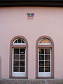
Friedrich-Diffiné-Haus - The building ensemble of the Friedrich-Diffiné-Haus opposite the St. Andrew's Church consists of a baroque mansard hipped roof building from 1732/37 and a classicist farm building from 1844. It serves as a village community center and the adult education center will also be located on the premises Kirchheim-Bissersheim operated.

St. Andrew's Church with a baroque tower dome

Friedrich Diffiné House, main building portal
Friedrich Diffiné House, farm building

Schoolhouse from 1903/04


Wormsischer Klosterhof - The Wormsischer Klosterhof , the name of which refers to the former prince-bishopric of Worms , is a three-sided courtyard with a Renaissance stair tower that has been attested since 1617 .
Old Town Hall - The old town hall has ornamental frameworks with motifs from Gothic and Renaissance and is mentioned in documents in 1574 and 1595.
Schoolhouse - The schoolhouse to the west of the Friedrich-Diffiné-Haus was built in 1903/04 according to plans by the Mannheim architect Albert Friedrich Speer (father of the Nazi architect of the same name ) as a late historical plastered building and now houses the town's primary school.
Eckbachmühlen - The Eckbach-Mühlenwanderweg runs along the Eckbach . In the past, numerous mills were operated by the stream; Kandel or Oligmühle , Eselsmühle and Gräfliche Leininger Mühle are more or less well preserved in the area around the village . The latter was originally called Kochsche Mühle ; It owes its popular name to the fact that it was owned by Countess Christiane Wilhelmine zu Leiningen in 1751/52, who married Carl Friedrich Wilhelm zu Leiningen in 1749 , the first Leininger to be promoted to prince.
To the northeast of the village, in the direction of Grünstadt , was the Kirchheim Templar House , which was lost in the 16th century . This was initially a commander of the Knights Templar , later it served as a branch of the Order of Malta and as an infirmary .
graveyards
The following are also designated as monument zones:
- the community cemetery on Kleinkarlbacher Strasse (laid out in 1835) with classicist and historicist tombs that were created in the 19th and early 20th centuries;
- the Jewish cemetery on the B 271 south of the building line, which was occupied from 1887 to 1962 and still has eight gravestones placed between 1907 and 1918.
Regular events
A nationally known cultural highlight of the place has been the Kirchheim concert winter every year since 1990 . From September to March, six concerts, each with a thematic focus, will take place in St. Andrew's Church. The focus is on chamber music works and often the rediscovery of forgotten composers. The founder and artistic director of the concert series is the bass-baritone and Bach Prize winner Dominik Wörner .
The German Wine Road marathon , which has been held every two years since 1998 , runs through the town .
Economy and Infrastructure
economy
The main economic factors are viticulture and tourism . Kirchheim belongs to the Palatinate wine-growing region Mittelhaardt-Deutsche Weinstrasse . The large black earth as well as the individual layers Geißkopf , Kreuz , Römerstraße and Steinacker exist on site .
traffic
train
The single-track railway line Neustadt - Bad Dürkheim - Grünstadt - Monsheim runs through the village, the stopping point and former station Kirchheim is served by regional trains in regular intervals. The public transport system is in the transport association Rhein-Neckar integrated (VRN), apply the Community tariffs. Trains run on the Neustadt – Grünstadt and Frankenthal - Ramsen routes .
Street
-_bei_Gastst%C3%A4tte_Zum_Leininger_Land_26.4.2008.jpg)


The place is 2 km south of the Autobahn 6 ( Saarbrücken - Mannheim ); the closest junction, Grünstadt, is in the Kirchheim district despite its name. The federal road 271 (Bad Dürkheim – Monsheim), here identical to the German Wine Road, ran through the middle of Kirchheim until 2018 and over a level crossing secured with half barriers; The Kleinkarlbacher Straße has a similar transition. Landesstrasse 520, Kreisstrasse 1 and Deutsche Alleenstrasse also run through Kirchheim .
The construction of a bypass for the B 271 has been sought by the residents for several decades. A citizen who was affected by accidental damage to his house recommended a diversion through a label on the outer wall with an ironic turn-off .
In February 2009, after a six-year procedure , the State Office for Mobility in Speyer issued a plan approval decision that laid down the western bypass . At the time, it was supposed to cost 16.4 million euros and of the 13,000 vehicles (recorded in 2005) to keep about 11,000 from passing through town every day. The western bypass had been under construction since August 2015. In the end, it cost almost 22 million euros and was largely completed in November 2018.
Internally, the advantages and disadvantages of a west or east route had long been argued in advance . The east route would have been cheaper because it has already been implemented in this form between Neustadt an der Weinstrasse and Bad Dürkheim and Kirchheim's neighboring communities are also planning it; it would also have led through flatter and cheaper farmland . The western route, which was favored by a majority among the citizens, used up valuable vineyard land in the opinion of their opponents and required additional crossings and bridges with both the old B 271 and the railway line.
Biking and hiking trails
The community is located on the German Wine Route and the Eckbach-Mühlenwanderweg .
Volunteer firefighter
In the spring of 2009, a new fire station was put into operation on Kleinkarlbacher Strasse , which houses the Kirchheim-Kleinkarlbach base fire department . Because the exit to the street is on a curve, a special traffic light had to be installed.
Personalities
Sons and daughters of the place
- Ottilie Kranich von Kirchheim (* around 1450), mother of the Speyer prince-bishop Philipp von Flersheim and mother-in-law of the knight Franz von Sickingen
- Johann Conrad Fabritius (1673–1722), Countess of the Liningian high school of Grünstadt (epitaph at the Martinskirche Grünstadt )
- Johann Friedrich Christian Hess (1785–1845), architect of classicism, son of J. G. C. Hess
- Willi Jakobs, long-time mayor, local researcher
Other personalities
- Johann Georg Christian Hess (1756–1816), classicist architect, father of J. F. C. Hess
- Albert Friedrich Speer (1863–1947), architect, designed the local schoolhouse in 1903 and 1904
- Theo Fehn (1910–1984), pastor of the Evangelical Church of the Palatinate as well as bell expert and appraiser, retired from 1974 onwards
- Dieter Schroth (* 1948), men's outfitter, has lived in Kirchheim since 2015
- Manfred Schwarz (* 1956) opened the Schwarz Restaurant on site in 2017
- Harald Glööckler (* 1965), fashion designer, has lived in Kirchheim since July 2015.
- Dominik Wörner (* 1970), founder and director of the Kirchheim Concert Winter
- Sylvia Benzinger (* 1978), German Wine Queen 2005/2006, grew up in Kirchheim.
literature
- Heinrich J. Keller and Willi Jakobs: My home book. From past and present days of Kirchheim an der Weinstrasse . Ed .: Kirchheim an der Weinstrasse community. 3rd edition, edited and supplemented by Willi Jakobs. Kirchheim 1992.
- Willi Jakobs: Monument to dark times . Cemetery and synagogue of the Jewish community in Kirchheim. In: Bad Dürkheim district (Hrsg.): Home year book of the Bad Dürkheim district . tape 15 (1997) . Verlag Englram & Partner, Haßloch 1996, ISBN 3-926775-15-7 , p. 177-179 .
- Literature about Kirchheim an der Weinstrasse in the Rhineland-Palatinate state bibliography
Web links
- Verbandsgemeinde Grünstadt-Land: Kirchheim
- SWR : Hierzuland Rhineland-Palatinate: Kirchheim , town portrait with video, January 19, 2003
- Kirchheim concert winter
- Kirchheimer Weinwelt
Individual evidence
- ↑ State Statistical Office of Rhineland-Palatinate - population status 2019, districts, communities, association communities ( help on this ).
- ↑ Website of the Kirchheim community
- ↑ www.redok.de: No mill for the NPD , August 20, 2006 ( Memento from July 19, 2011 in the Internet Archive ) (queried August 17, 2007)
- ↑ Press release of the Police Headquarters Rheinpfalz, Ludwigshafen, May 16, 2006 ( Memento from July 19, 2011 in the Internet Archive ) (queried August 17, 2007)
- ↑ a b Die Rheinpfalz , local edition Unterhaardter Rundschau: “Stone of contention is removed” , April 29, 2009
- ↑ KommWis, as of December 31, 2007
- ^ The Regional Returning Officer RLP: Municipal Council Election 2019 Kirchheim. Retrieved October 13, 2019 .
- ^ The Regional Returning Officer Rhineland-Palatinate: Municipal elections 2014, city and municipal council elections
- ^ The Regional Returning Officer RLP: direct elections 2019. see Leiningerland, Verbandsgemeinde, 13th line of results. Retrieved October 13, 2019 .
- ^ Karl Heinz Debus: The great book of arms of the Palatinate . Neustadt an der Weinstrasse 1988, ISBN 3-9801574-2-3
- ↑ a b General Directorate for Cultural Heritage Rhineland-Palatinate: Informational directory of cultural monuments: Bad Dürkheim district (PDF; 1.6 MB)
- ↑ "We are only one step further" . In: Die Rheinpfalz , local edition Unterhaardter Rundschau . February 12, 2009.
- ^ Anja Benndorf: Kirchheim: Construction of the western bypass is going well. In: The Rhine Palatinate . June 25, 2018, accessed December 8, 2018 .
- ↑ Anja Benndorf: West bypass Kirchheim: traffic rolls half a year earlier. In: The Rhine Palatinate . November 2, 2018, accessed December 10, 2018 .
- ↑ a b B 271 East instead of West. Pro Ost e. V., accessed December 10, 2018 .

Altleiningen | Bad Dürkheim | Battenberg (Palatinate) | Bissersheim | Bobenheim am Berg | Bockenheim an der Weinstrasse | Carlsberg | Dackenheim | Deidesheim | Dirmstein | Ebertsheim | Ellerstadt | Elmstein | Erpolzheim | Esthal | Forest on the Wine Route | Frankeneck | Freinsheim | Friedelsheim | Gerolsheim | Gönnheim | Grosskarlbach | Grünstadt | Hassloch | Herxheim am Berg | Hettenleidelheim | Kallstadt | Children's home | Kirchheim an der Weinstrasse | Kleinkarlbach | Lambrecht (Palatinate) | Laumersheim | Lindenberg | Meckenheim | Mertesheim | Neidenfels | Neuleiningen | Niederkirchen near Deidesheim | Obersülzen | Obrigheim (Palatinate) | Quirnheim | Ruppertsberg | Tiefenthal | Wachenheim an der Weinstrasse | Wattenheim | Weidenthal | Weisenheim am Berg | Weisenheim am Sand