Williams Lake Airport
| Williams Lake Airport | ||
|---|---|---|
|
|
||
| Characteristics | ||
| ICAO code | CYWL | |
| IATA code | YWL | |
| Coordinates | ||
| Height above MSL | 940 m (3084 ft ) | |
| Transport links | ||
| Distance from the city center | 14 km north of Williams Lake | |
| Basic data | ||
| opening | 1956 | |
| operator | City of Williams Lake | |
| Terminals | 1 | |
| Flight movements |
13,854 (as of 2010) | |
| Start-and runway | ||
| 11/29 | 2134 m × 46 m asphalt | |
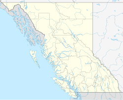
The Williams Lake Airport is a regional airport in the Canadian province of British Columbia . The airport is open 24 hours a day, all year round. It is in the UTC-8 (DST-7) time zone.
history
The airport opened in 1956. After Transport Canada was the operator for a long time , the city of Williams Lake became the operator of the airport in 1997 . However, the owner is still Transport Canada.
Start-and runway
Navigation and landing aids: VOR NDB , PAPI , ODALS ,
- Runway 11/29, length 2133 m, width 45 m, asphalt
service
The following types of aviation fuel are available at the airport:
Flight connections
The airport is served by Central Mountain Air , Pacific Coastal Airlines , Arduini Helicopters Ltd. , Lawrence Aviation , Sharp Wings Ltd .
Central Mountain Air and Pacific Coastal Airlines maintain from here z. B. Connections to Vancouver .
Web links
Individual evidence
- ↑ Total aircraft movements by class of operation. Statistics Canada , May 5, 2011, accessed November 22, 2012 .
- ↑ Airport diagram. (PDF; 76.5 MB) In: NAV CANADA . Accessed April 6, 2018 .
