Geresdlak
| Geresdlak | ||||
|
||||
| Basic data | ||||
|---|---|---|---|---|
| State : | Hungary | |||
| Region : | Southern Transdanubia | |||
| County : | Baranya | |||
| Small area until December 31, 2012 : | Mohács | |||
| Coordinates : | 46 ° 7 ' N , 18 ° 32' E | |||
| Area : | 25.28 km² | |||
| Residents : | 768 (Jan. 1, 2011) | |||
| Population density : | 30 inhabitants per km² | |||
| Telephone code : | (+36) 69 | |||
| Postal code : | 7733 | |||
| KSH kódja: | 02857 | |||
| Structure and administration (as of 2016) | ||||
| Community type : | local community | |||
| Structure : | Geresd, Püspöklak | |||
| Mayor : | Attila Tibor Habjánecz (independent) | |||
| Postal address : | Hunyadi János u. 22 7733 Geresdlak |
|||
| Website : | ||||
| (Source: A Magyar Köztársaság helységnévkönyve 2011. január 1st at Központi statisztikai hivatal ) | ||||
Geresdlak ( German Gereschlak , Croatian Gereš ) is a Hungarian municipality in Baranya County . It belongs to the Pécsvárad district.
Location and surroundings
Geresdlak is located in a valley on the east side of the Mecsek Mountains . The largest town in the area is the city of Pécsvárad .
history
Geresdlak was created in 1968 by merging the municipalities of Geresd and Püspöklak . Geresd was mentioned in a document as early as 1292 under the name Gueresty .
Attractions
- Gőzgombóc Festival ( Gőzgombóc Fesztivál )
- Local history museum ( Tájház )
- Koffán House ( Koffán-Ház ) Art Gallery
- Doll exhibition ( Babakiállítás )
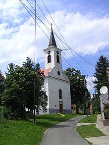
- Roman Catholic Church Remete Szent Pál , built in 1794 (Baroque)
- Roman Catholic Church Szent Bertalan , built in 1828 (late baroque)
traffic
Country road no. 5607 runs through Geresdlak. The nearest train station is to the southeast in Mohács .
Web links
Commons : Geresdlak - collection of images, videos and audio files


