Gers (river)
| Gers | ||
|
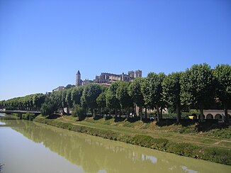
The Gers flows through the city of Auch |
||
| Data | ||
| Water code | FR : O6-0250 | |
| location | Southwest France | |
| River system | Garonne | |
| Drain over | Garonne → Atlantic Ocean | |
| source | In the municipality of Lannemezan, 43 ° 6 ′ 2 ″ N , 0 ° 23 ′ 40 ″ E |
|
| Source height | approx. 630 m | |
| muzzle | at Layrac in the Garonne coordinates: 44 ° 8 ′ 41 ″ N , 0 ° 38 ′ 52 ″ E 44 ° 8 ′ 41 ″ N , 0 ° 38 ′ 52 ″ E |
|
| Mouth height | approx. 39 m | |
| Height difference | approx. 591 m | |
| Bottom slope | approx. 3.4 ‰ | |
| length | approx. 175 km | |
| Left tributaries | Gèze, Cédon , Sousson , Talouch, Ousse, Lauze , Auchie | |
| Right tributaries | Cier, Arçon , Aulouste | |
| Medium-sized cities | Also | |
| Small towns | Fleurance | |
The Gers is a river in southwestern France . It rises on the plateau of Lannemezan , in the Hautes-Pyrénées department, and generally drains in a northerly direction. After 175 kilometers it flows into the Garonne as a left tributary at Layrac , southeast of Agen . The Gers department was named after this river.
Crossed departments
in the Occitania region :
in the Nouvelle-Aquitaine region :
Places on the river
Web links
Commons : Gers River - collection of images, videos and audio files
