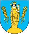
Gmina Dzierżoniów
| Gmina Dzierżoniów | ||
|---|---|---|

|
|
|
| Basic data | ||
| State : | Poland | |
| Voivodeship : | Lower Silesia | |
| Powiat : | Dzierżoniów | |
| Geographic location : | 50 ° 44 ′ N , 16 ° 39 ′ E | |
| Residents : | see Gmina | |
| Telephone code : | (+48) 74 | |
| License plate : | DDZ | |
| Economy and Transport | ||
| Next international airport : | Wroclaw | |
| Gmina | ||
| Gminatype: | Rural community | |
| Gmina structure: | 15 school offices | |
| Surface: | 142.05 km² | |
| Residents: | 9114 (June 30, 2019) |
|
| Population density : | 64 inhabitants / km² | |
| Community number ( GUS ): | 0202052 | |
| Administration (as of 2013) | ||
| Mayor : | Marek Chmielewski | |
| Address: | ul.Piastowska 1 58-200 Dzierżoniów |
|
| Website : | www.ug.dzierzoniow.pl | |
The Gmina Dzierżoniów [ 'gmina d͡ʑerˈʐɔɲuf ] is a rural community in the powiat Dzierżoniowski (Reichenbach district) in the Polish Voivodeship of Lower Silesia . The seat of the municipality is the district town of Dzierżoniów ( German Reichenbach ).
geography
The municipality surrounds the city of Dzierżoniów from the north and east. It is the administrative seat of the rural community, but does not belong to it, but forms an independent urban community.
Community structure
Gmina Dzierżoniów is divided into 33 districts with a Schulzenamt (sołectwo) :
| District | Population (2009) |
|---|---|
| Dobrocin (Güttmannsdorf) | 702 |
| Jędrzejowice (Endersdorf) | 92 |
| Jodłownik (Tannenberg) | 454 |
| Kiełczyn (Költschen) | 273 |
| Książnica (Pfaffendorf) | 426 |
| Mościsko (Faulbrück) | 1133 |
| Myśliszów (Karlswalde) | 95 |
| Nowizna (Neudorf (owl)) | 382 |
| Ostroszowice (Weigelsdorf) | 1281 |
| Owiesno (Habendorf) | 525 |
| Piława Dolna (Lower Middle Peilau) | 1558 |
| Roztocznik (Olbersdorf) | 491 |
| Tuszyn (Hennersdorf) | 381 |
| Uciechów (Berthol [d] sdorf) | 1050 |
| Włóki (Dreißighuben) | 518 |
The following settlements or hamlets are also assigned to the above districts:
- Albinów (Neu Harthau)
- Borowica (Harthau)
- Byszów (Seherrswaldau)
- Dębowa Góra (Eichberg)
- Dobrocinek (Klein Güttmannsdorf)
- Kietlice (Kittlitzheide)
- Kołaczów (Prauß)
- Marianówek (Marienhof)
- Wiatraczyn (Weissemühle)
Individual evidence
- ↑ population. Size and Structure by Territorial Division. As of June 30, 2019. Główny Urząd Statystyczny (GUS) (PDF files; 0.99 MiB), accessed December 24, 2019 .
- ↑ Italic : German place names up to 1945; The Genealogical Place Directory
- ↑ See population figures as of December 31, 2009 ug.dzierzoniow.pl ; Retrieved December 7, 2013

