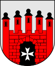
Gmina Słońsk
| Gmina Słońsk | ||
|---|---|---|

|
|
|
| Basic data | ||
| State : | Poland | |
| Voivodeship : | Lebus | |
| Powiat : | Sulęciński | |
| Geographic location : | 52 ° 34 ' N , 14 ° 48' E | |
| Height : | 23 m npm | |
| Residents : | see Gmina | |
| Postal code : | 66-436 | |
| Telephone code : | (+48) 95 | |
| License plate : | FSU | |
| Economy and Transport | ||
| Street : | Berlin - Warsaw | |
| Next international airport : | Szczecin-Goleniów | |
| Gmina | ||
| Gminatype: | Rural community | |
| Gmina structure: | 11 localities | |
| Surface: | 158.86 km² | |
| Residents: | 4755 (Jun. 30, 2019) |
|
| Population density : | 30 inhabitants / km² | |
| Community number ( GUS ): | 0807032 | |
| Administration (as of 2007) | ||
| Wójt : | Janusz Krzyśków | |
| Address: | ul.Sikorskiego 15 66-436 Słońsk |
|
| Website : | www.slonsk.pl | |
The Gmina Słońsk is a rural community in the Sulęciński powiat of the Lubusz Voivodeship in Poland . Your seat is the former city ( German Sonnenburg ) with about 3000 inhabitants.
geography
The municipality borders in the west on the town of Kostrzyn nad Odrą (Küstrin) , its northern border is the Warta . About a third of their area belongs to the Warta Estuary National Park , one of the largest bird sanctuaries in Europe.
structure
The rural community Słońsk comprises 11 villages (German names until 1945) with school offices:
|
Personalities
- Carl Friedrich von Müller (1768–1824), officer and landowner; born in Gartow.
Web links
Commons : Gmina Słońsk - collection of pictures, videos and audio files
Individual evidence
- ↑ population. Size and Structure by Territorial Division. As of June 30, 2019. Główny Urząd Statystyczny (GUS) (PDF files; 0.99 MiB), accessed December 24, 2019 .

