Goldbach (Bode)
| Goldbach | ||
|
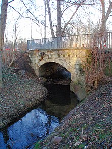
The Eggeröder fountain is considered the source of the Klostergrundbach stream. |
||
| Data | ||
| Water code | DE : 56852 | |
| location | Germany ( Saxony-Anhalt ) | |
| River system | Elbe | |
| Drain over | Bode → Saale → Elbe → North Sea | |
| source | at Hartenberg near Elbingerode 51 ° 47 ′ 31 ″ N , 10 ° 49 ′ 49 ″ E |
|
| Source height | approx. 516 m above sea level NHN | |
| muzzle | in Wegeleben in the Bode coordinates: 51 ° 53 '33 " N , 11 ° 10' 52" E 51 ° 53 '33 " N , 11 ° 10' 52" E |
|
| Mouth height | 91 m above sea level NN | |
| Height difference | approx. 425 m | |
| Bottom slope | approx. 13 ‰ | |
| length | approx. 34 km with Teufelsbach | |
| Catchment area | 101 km² | |
| Reservoirs flowed through | (Klostergrundbach) Small Hasenteich , Large Silver Pond , Mönchenmühlenteich | |
The Goldbach is an approx. 34 km long, left tributary of the Bode , rises in the Harz Mountains and flows out about 20 km north of the mountain edge.
course
The Goldbach rises near Elbingerode at an altitude of approximately 516 m on the eastern slope of the Hartenberg . At the Mönchenmühle on the northern edge of Blankenburg , at 213.6 m, it meets the Klostergrundbach coming from the Eggeröder Brunnen (about 470 m above sea level), which is already called Goldbach on some maps and which forked shortly before. The northern arm is its main arm, the southern one unites with the Silberborn flowing under the Michaelstein monastery . Some authors see the actual source of the Goldbach in the Eggeröder fountain.
The name Goldbach undoubtedly begins at the Mönchenmühle. When leaving the Harz, the brook makes an S-curve to the Pfeifenkrug . At Langenstein it flows hard along the foot of the Hoppelberg . At the foot of the Spiegelbergs it flows through the southern outskirts of Halberstadt . In the south-east neighboring Harsleben it flows through the old town center. It is then integrated into the drainage network of the arable land between Halberstadt and Wegeleben . After a straightened tour through the village, it reaches the Bode between Wegeleben and its district Adersleben , 34 km after the source on the Hartenberg and just 25.7 km after the Mönchenmühle.
Historical references
A place previously documented by Emperor Otto I as Egininkisrod was located at the source area . This was called Engerode , an important ironworks place in the Middle Ages. After the mining phase ended, the place fell desolate . More recently, the place has been revived as a holiday home forest settlement. In 1946 the settlement was renamed Jasperode in honor of Heinrich Jasper . This name has not officially been used since 1990, but is still the name of one of the streets in this settlement.
environment
In the spring the Goldbach develops in places in the upper reaches into a raging meltwater stream.
Its upper course is considered natural. Numerous endangered animal species live here, such as the brown trout and small shellfish. The upper course of the stream is lined with Allium ursinum (white flowering wild garlic). In the renatured area meanwhile u. a. Black stork , white stork , banded demoiselle and various amphibian species observed.
Renaturation
During the construction of the B 6n were performed on gequerten streams Ecker , Harsleber Bach , Hennenbach and Goldbach extensive restoration measures , which also Rammelsbach with Nonnenbach mouth , Schneibecke , Holtemme and vocal corner the existing riparian zones have been improved or created.
In the transition from the Harz to the Harz foreland, between Blankenburg (Harz) and Langenstein , the Goldbach has been an ecologically continuous river from the source to the mouth again since the measures were completed in 2010.
In the area of the Goldbach, 1,461 m of new river course was created. For this purpose, the section running on the dam was abandoned and partially backfilled.
Spring streams
- Teufelsbach (hydrographic upper course, left, GKZ: 568521)
- Mönchsgrundbach (optional named upper course, right or middle, GKZ: 568522)
Tributaries
- Silberborn (with the right arm of the Mönchsgrundbach, possibly a third source stream, GKZ: 568524)
- Molkegraben (right)
- Sauteichsgraben (left)
Drains
- New ditch (left)
- Buschgraben (left)
See also
Web links
Individual evidence
- ↑ a b c Saxony-Anhalt viewer with map content of waters and area measurement function
- ↑ a b Saxony-Anhalt viewer and GPS track drawn using the Saxony-Anhalt viewer
- ↑ a b Along the Goldbach, Zum Eggeröder Brunnen, in: Von der Pfalz Derenburg in the Harz, information sheet of the Regionalverband Harz e. V. PDF online ( Memento from February 1, 2014 in the Internet Archive )
- ↑ Harzer JH-Reisen. Rivers ( Memento of the original from March 4, 2016 in the Internet Archive ) Info: The archive link was inserted automatically and has not yet been checked. Please check the original and archive link according to the instructions and then remove this notice.
- ↑ a b page no longer available , search in web archives: Water restoration along the B6n in the northern Harz foreland

