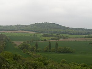
Hoppelberg
| Hoppelberg | ||
|---|---|---|
|
The Hoppelberg as seen from the Transparent Monk |
||
| height | 308 m above sea level NHN | |
| location | northern Harz foreland (Subherzyn), Harz district , Saxony-Anhalt | |
| Coordinates | 51 ° 50 ′ 29 ″ N , 11 ° 0 ′ 11 ″ E | |
|
|
||
| Type | Layer rib | |
| rock | Sandstone | |
| Age of the rock | Lower Cretaceous | |
The Hoppelberg is a striking, 308 m above sea level. NHN high elevation southeast of the Halberstadt suburb of Langenstein in the Harz district in Saxony-Anhalt .

On the Hoppelberg near Langenstein. Visible in the right half of the trees are pending "Neocomian sandstone" and in the middle, in the background, former ZV-building and a TP-pillars .
It is a layered comb made of silicified (quartz-cemented) sandstone from the Lower Cretaceous (" Neokom sandstone").
Geologically, the Hoppelberg lies on the saddle axis of the Quedlinburg saddle and thus forms the north-western border between Blankenburger and Halberstädter Mulde. The mountain is located in the nature reserve of the same name.
Immediately on the summit, next to an old quarry, is the vacant building of an observation post of the former civil defense .
Web links
Individual evidence
- ↑ Gerald Patzelt: Collection of geological guides, Volume 96, Northern Harz Foreland (Subherzyn), eastern part. Bornträger Brothers, Berlin 2003, ISBN 3-443-15079-9 .


