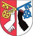
Trubin
| Trubin | ||||
|---|---|---|---|---|
|
||||
| Basic data | ||||
| State : |
|
|||
| Region : | Středočeský kraj | |||
| District : | Beroun | |||
| Area : | 372.2788 ha | |||
| Geographic location : | 49 ° 57 ' N , 14 ° 0' E | |||
| Height: | 280 m nm | |||
| Residents : | 478 (Jan 1, 2019) | |||
| Postal code : | 267 01 | |||
| License plate : | S. | |||
| traffic | ||||
| Street: | Králův Dvůr - Svatá | |||
| Next international airport : | Prague airport | |||
| structure | ||||
| Status: | local community | |||
| Districts: | 1 | |||
| administration | ||||
| Mayor : | Jan Langhans (as of 2013) | |||
| Address: | Trubín 26 267 01 Králův Dvůr |
|||
| Municipality number: | 533106 | |||
| Website : | www.trubin.cz | |||
| Location of Trubín in the Beroun district | ||||

|
||||
Trubín (German Trubin ) is a municipality in the Czech Republic . It is located six kilometers southwest of Beroun and belongs to the Okres Beroun .
geography
Trubín is on the edge of the nature reserve Křivoklátsko in the Křivoklátská highlands. The village lies at the confluence of the streams Trubínský potok and Počapelský potok, with the Trubínský potok flowing through the center and the Počapelský potok on the southern outskirts. The Lísek (483 m) rises to the north, the Děd (492 m) to the northeast , the Koukolova hora (471 m) to the south, the Kníhov (369 m), the Hříbce (385 m) and the Vraní skála (536 m) to the southwest ) and to the west the Dubová (455 m) and the Trubínský vrch (369 m).
Neighboring towns are Trubská and Lísek in the north, Zahořany in the northeast, Králův Dvůr and Počaply in the east, Karlova Huť and Popovice in the southeast, Levín and Zdice in the south, Černín in the southwest, Svatá , Svatská Hájovna and Varta in the west and Hudlice in the northwest.
history
Archaeological finds show that the municipality has been settled since the Bronze Age .
Troubin was first mentioned in writing in 1125 as the property of the Benedictine monastery of Insula . After the monastery was destroyed by Brandenburg troops in 1278, King Wenceslaus II left the village to the royal city of Beroun . Wenceslaus IV struck Trubín around 1406 as part of his royal castles Žebrák and Točník . In the middle of the 15th century, the lordship of the castle was pledged to the Lords of Wartenberg . Emperor Ferdinand I sold the Točník domain to Johann Ferdinand Popel von Lobkowicz in 1557 . His grandson Georg lost all property in 1593 because of an intrigue against Emperor Rudolf II . In 1594 the confiscated Točník lordship was combined with the Zbiroh lordship and the royal court to form a cameraman whose captain had his seat in the Zbiroh castle. The administration and the income of the Königshofer share of the cameraman Zbirow were assigned to the kk Montan-Aerar in 1834 as kk Montan-Herrschaft or Berg-Cameralherrschaft Königshof. It remained subordinate to the kk Oberamt Zbirow, but was given an administrator.
In 1846 Trubin or Trubjn consisted of 25 houses with 223 inhabitants, including two Protestant families of the Augsburg Confession . The iron ore mine St.-Caroli-Zeche was operated by the rule Pürglitz in the administrative forest Dubowa . The Catholic parish was Počapl . Until the middle of the 19th century, the village remained subordinate to the kk Montan-Herrschaft Königshof in the Berauner district .
After the abolition of patrimonial Trubín formed with the district Levín from 1850 a municipality in the judicial district of Beraun . In 1868 the municipality was assigned to the Hořowitz district . Levín became independent in 1881. In 1932 Trubín had 380 inhabitants. The community has belonged to Okres Beroun since 1936. In 1976 Trubín was attached to the town of Králův Dvůr . On January 1, 1980, it was incorporated into Beroun, after which the village formed the district of Beroun-Trubín . Trubín has been independent again since November 24, 1990. The new housing estate U staré cihelny has been built in the southern part of the cadastre on the other side of Počapelský potok since the 1990s .
Community structure
No districts are shown for the municipality of Trubín.
Attractions
- Chapel of St. John of Nepomuk on the village square
- Memorial to the fallen of the First World War on the village square
- Trubínský vrch natural monument, rocky steppe ecosystem on the southern slope of the hill of the same name with rich fauna and flora as well as the occurrence of warmth-loving plants
Web links
Individual evidence
- ↑ http://www.uir.cz/obec/533106/Trubin
- ↑ Český statistický úřad - The population of the Czech municipalities as of January 1, 2019 (PDF; 7.4 MiB)
- ^ Johann Gottfried Sommer The Kingdom of Bohemia, Vol. 16 Berauner Kreis, 1849, p. 323


