Cerhovice
| Cerhovice | ||||
|---|---|---|---|---|
|
||||
| Basic data | ||||
| State : |
|
|||
| Region : | Středočeský kraj | |||
| District : | Beroun | |||
| Geographic location : | 49 ° 51 ' N , 13 ° 50' E | |||
| Height: | 411 m nm | |||
| Residents : | 1,183 (Jan 1, 2019) | |||
| Postal code : | 267 61 | |||
| traffic | ||||
| Street: | Autobahn 5 | |||
| structure | ||||
| Status: | Městys | |||
| Districts: | 2 | |||
| administration | ||||
| Mayor : | Petr Frei (as of 2013) | |||
| Address: | nám. Kapitána Kučery 10 267 61 Cerhovice |
|||
| Municipality number: | 531138 | |||
| Website : | www.cerhovice.cz | |||
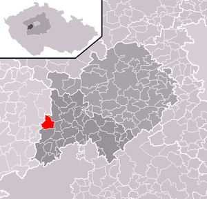
| Location of Cerhovice in the Beroun district | ||||

|
||||
Cerhovice ( Ger . Zerwitz ) is a municipality in the Czech Republic . It is located 30 kilometers southeast of Beroun on the Autobahn 5 and belongs to the Okres Beroun .
history
Archaeological finds prove that the municipality was settled during the Bronze Age .
Community structure
The municipality of Cerhovice consists of the districts Cerhovice and Třenici.
Attractions
- Church of St. Martin in the main square
- Tomb of the Röthlingshöfer family
Web links
Commons : Cerhovice - collection of pictures, videos and audio files
Individual evidence
- ↑ Český statistický úřad - The population of the Czech municipalities as of January 1, 2019 (PDF; 7.4 MiB)
- ↑ Antonin Profous: Místní jména v Čechách: Vznik jejich, Původ, význam a změny. Vol. I.-IV .; Prague.
- ↑ http://digitool.is.cuni.cz:1801/view/action/nmets.do?DOCCHOICE=795704.xml&dvs=1531681385001~302&locale=de_DE&search_terms=&adjacency=&VIEWER_URL=/view/action/nLEmets.do ? . & 3 & divType =

