Rpety
| Rpety | ||||
|---|---|---|---|---|
|
||||
| Basic data | ||||
| State : |
|
|||
| Region : | Středočeský kraj | |||
| District : | Beroun | |||
| Area : | 592.5377 ha | |||
| Geographic location : | 49 ° 50 ' N , 13 ° 57' E | |||
| Height: | 360 m nm | |||
| Residents : | 487 (Jan. 1, 2019) | |||
| Postal code : | 268 01 | |||
| License plate : | S. | |||
| traffic | ||||
| Street: | Hořovice - Felbabka | |||
| structure | ||||
| Status: | local community | |||
| Districts: | 1 | |||
| administration | ||||
| Mayor : | Alena Hasmanová (as of 2013) | |||
| Address: | Rpety 26 268 01 Hořovice |
|||
| Municipality number: | 531715 | |||
| Website : | www.rpety.cz | |||
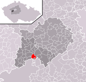
| Location of Rpety in the Beroun district | ||||

|
||||
Rpety (German Erpet ) is a municipality in the Czech Republic . It is located three kilometers southeast of Hořovice and belongs to the Okres Beroun .
geography
The village through which the Podlužský potok flows is located north of the Brdy Forest on the north-eastern edge of the Brdy military training area . In the southeast rises the Ostrý (538 m), behind which the Litavka emerges into a deeply cut valley from the Brdy.
Neighboring towns are Tihava and Netolice in the north, Lochovice and Obora in the north-east, Lhotka in the east, Rejkovice in the south-east, Felbabka in the south, Podluhy in the south-west, Dražovka in the west and Hořovice in the north-west.
history
Rpety was first mentioned in the course of the foundation of the Kladruby monastery by Vladislav I. Since the founding deed of the monastery from 1115 turned out to be a subsequent falsification from the end of the 12th century, the first documentary mention of the village dates from 1186.
After the town was divided in the 14th century, one part belonged to Příbram and the other to Komárov until 1436 . The earlier Příbram portion came to the Jince rule in 1520 and to the Hořovice rule in the 17th century . In addition, five farms belonged to the Točník lordship and the monastery of St. Benigna near Zaječov since the end of the 16th century .
In 1707, Rozina Wischtejnová, a woman, held the position of judge in the village. Iron ore was mined on the Ostrý in the 18th and 19th centuries. The shafts reached a depth of approx. 100 m and the tunnels were driven approx. 700 m into the mountain. Although many of the residents worked for the mines, Rpety did not become a mountain settlement, but retained its agricultural character. In addition, the inhabitants also subsisted on woodcutting and charcoal burning for the needs of the ironworks. Objects were made of iron in homework, and the blacksmithing trade was particularly widespread.
After the replacement of patrimonial Rpety with the district Felbabka in 1850 became an independent municipality in the Prague district.
In 1910 Rpety had 492 inhabitants, and in 1921 exactly the same number of people lived in the 80 houses in the village. The former district of Felbabka gained independence in 1954.
Attractions
- Ostrý mountain with the remains of a medieval castle and iron ore mines
- small chapel on the village square
Individual evidence
- ↑ http://www.uir.cz/obec/531715/Rpety
- ↑ Český statistický úřad - The population of the Czech municipalities as of January 1, 2019 (PDF; 7.4 MiB)

