Srbsko
| Srbsko | ||||
|---|---|---|---|---|
|
||||
| Basic data | ||||
| State : |
|
|||
| Region : | Středočeský kraj | |||
| District : | Beroun | |||
| Area : | 656.3438 ha | |||
| Geographic location : | 49 ° 56 ' N , 14 ° 8' E | |||
| Height: | 225 m nm | |||
| Residents : | 557 (Jan. 1, 2019) | |||
| Postal code : | 267 18 | |||
| License plate : | S. | |||
| traffic | ||||
| Street: | Beroun - Řevnice | |||
| Railway connection: | Prague – Plzeň | |||
| structure | ||||
| Status: | local community | |||
| Districts: | 1 | |||
| administration | ||||
| Mayor : | Jaroslav Bastl (as of 2013) | |||
| Address: | Srbsko 16 267 18 Karlštejn |
|||
| Municipality number: | 531758 | |||
| Website : | www.obecsrbsko.cz | |||
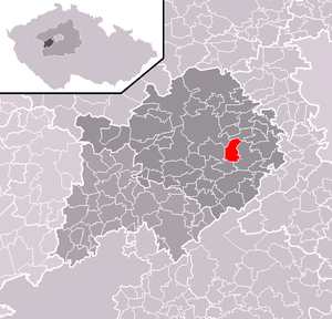
| Location of Srbsko in the Beroun district | ||||

|
||||
Srbsko is a municipality in the Okres Beroun in Středočeský kraj in the Czech Republic . It is located about 6 km southeast of Beroun and about 35 km southwest of Prague . The municipality has 470 inhabitants (2006) and covers an area of 6.57 km². Srbsko lies at an altitude of about 225 m. The Berounka flows through Srbsko .
geography
Srbsko is located directly on the left bank of the Berounka. About a kilometer away from Srbsko, the Kačák stream flows into the Berounka, which can be traveled in the upper course by kayak and in the lower part by canoe. In the vicinity of Srbsko there is also a larger climbing area, the Český kras . The landscape is hilly to mountainous with forests and clearings. There are several caves in the area. The largest is the Barrandova jeskyně ( Barrandowa Cave ) with an extension of 120 meters and a depth of 45 meters.
etymology
Srbsko has the same meaning as Srbija in the Czech and Slovak languages .
history
Srbsko is mentioned for the first time in a surviving sales contract from 1428. Because of the name, some historians assume that Srbsko was founded by the Serbs from south-eastern Europe . The earlier establishment of the settlement by the Serbs or Sorbs is not excluded . The area was already settled by the Serbs in the early Middle Ages , as recorded for example in the De Administrando Imperio by Constantine VII Porphyrogennetus from the 10th century. This tells about the traditional departure of the Serbs (Serbloi) from Boiki in the vicinity of the Frankish Empire at the time of Herakleios at the beginning of the 7th century.
In 1846 Srbsko consisted of 33 houses with 255 inhabitants, including two Protestant families. There was a community school and an inn in the village. The parish was St. Johann . Until the middle of the 19th century the village remained subservient to the kk Tafel rulership of Karlstein in the Berauner district .
In 1902 a railway station was built in Srbsko and the small municipality was thus integrated into the national transport network. In 1938 Srbsko was connected to the electricity network. During the Second World War , Srbsko also suffered casualties. Some residents have been missing since 1942 after being transferred to the Theresienstadt concentration camp . Srbsko experienced severe flooding in 1981, with the bridge over the Berounka being badly affected.
Individual evidence
- ↑ http://www.uir.cz/obec/531758/Srbsko
- ↑ Český statistický úřad - The population of the Czech municipalities as of January 1, 2019 (PDF; 7.4 MiB)
- ↑ Kayak and canoe trip to the Kačák stream
- ^ Ethnography of the Austrian monarchy by Karl Czoernig 1852
- ^ Table of contents De Administrando Imperio (Serbian)
- ^ Johann Gottfried Sommer The Kingdom of Bohemia, Vol. 16 Berauner Kreis, 1849, p. 26


