Grohmannhütte
| Grohmannhütte | ||
|---|---|---|
|
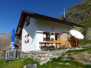
The Grohmanhütte seen from the southeast |
||
| location | upper Ridnaun valley; South Tyrol , Italy | |
| Mountain range | Stubai Alps | |
| Geographical location: | 46 ° 57 '6.4 " N , 11 ° 13' 53.2" E | |
| Altitude | 2254 m slm | |
|
|
||
| owner | Autonomous Province of Bolzano - South Tyrol | |
| Usual opening times | from the beginning of June to the end of September / beginning of October | |
| accommodation | 0 beds, 10 camps | |
| Hut directory | ÖAV DAV | |
The Grohmannhütte ( Italian Rifugio Vedretta Piana ) is a refuge in the South Tyrolean part of the Stubai Alps .
Location and surroundings
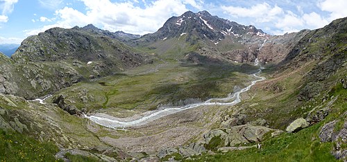
The Grohmannhütte is located at an altitude of 2254 m in the upper Ridnaun Valley near the Austrian - Italian border in the area of the municipality of Ratschings . The closest villages are Maiern and Ridnaun .
The easiest ascent to the hut is through the Ridanna Valley. The mountain peaks that can be reached from here include Agglsspitze , Feuerstein , Schneespitze , Wilder Freiger , Wilder Pfaff , Sonklarspitze and Botzer . A little to the northwest are the Teplitzer Hütte , the Becherhaus and the Müllerhütte . A transition to the Magdeburger Hütte in the Pflersch Valley is possible in a north-easterly direction . From the Grohmannhütte, following the path to the south, you cross the Egeltjoch and come to the former Schneeberg mining area .
history
The hut was built in 1887 by the Teplitz section of the DuÖAV as the Teplitz hut and opened on August 27th. In the winter of 1887/88 the hut was completely destroyed by a storm. As a result, the large Bohemian industrialist Theodor Grohmann financed a new building that was named after him for 1,534 florins . The new, albeit smaller, hut opened on August 14, 1889. After the First World War , the hut was expropriated by the Italian state and handed over to the CAI section in Sterzing . After it had stood empty for a few years and was partially dilapidated, it was completely renovated between 1998 and 2000.
Together with 24 other shelters expropriated by the state, the Grohmannhütte became the property of the Autonomous Province of Bolzano - South Tyrol in 1999; At the end of 2010, the license for their management by the CAI expired. Since 2015, the state of South Tyrol has been supported in the management of the hut (assignment to tenants, supervision of management, renovation measures) by a joint commission, in which the AVS and CAI are represented in addition to the public sector .
Web links
- Grohmannhütte in the historical Alpine archive of the Alpine clubs in Germany, Austria and South Tyrol (temporarily offline)
Individual evidence
- ^ Johannes Emmer: History of the German and Austrian Alpine Club . In: Journal of the German and Austrian Alpine Club . tape 25 , 1894, The road and hut buildings, p. 301 ( literature.at ).
- ↑ Hans Kammerer: Refuge huts in South Tyrol . Tappeiner, Lana 2008, ISBN 978-88-7073-422-5 , pp. 101 .
- ↑ Transition of the refuges: basis laid for leadership body. Autonomous Province of Bolzano - South Tyrol, press releases, October 2, 2009, accessed on January 30, 2012 .
- ↑ refuges. Autonomous Province of Bolzano - South Tyrol, Asset Management Department, accessed on January 30, 2012 .
- ^ Refuge: Agreement signed between Land, CAI and AVS. Autonomous Province of Bolzano - South Tyrol, press releases, July 8, 2015, accessed on July 8, 2015 .


