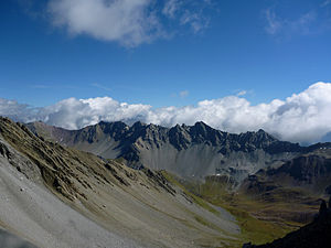
Guggernell ridge
| Guggernell ridge | ||
|---|---|---|
|
Guggernellgrat with Sandhubel (far left) and Guggernell (top right) |
||
| height | 2810 m above sea level M. | |
| location | Canton of Graubünden ( Switzerland ) | |
| Mountains | Plessur Alps | |
| Dominance | 2.5 km → Gamschtällihorn | |
| Notch height | 238 m ↓ Furcletta | |
| Coordinates | 768 993 / 177000 | |
|
|
||
| rock | crystalline | |
| Development | Hiking trails (up to the vicinity) | |
The Guggernellgrat is at 2810 m above sea level. M. the highest elevation of the Strela chain in the Plessur Alps in the canton of Graubünden / Switzerland . It extends on the ridge between Spitzig Gretli ( 2788 m above sea level ) and (the summit) Guggernell ( 2744 m above sea level ). Neighboring elevations are the Sandhubel ( 2763.9 m above sea level ) in the northeast and the Tgapeala Cotschna ( 2712 m above sea level ) in the southwest.
Location and description
The Guggernellgrat is located between the Welschtobel / Alp Ramoz near Arosa and the Landwassertal . It lies on the territory of the municipalities of Albula / Alvra , Arosa, Schmitten and Wiesen (now Davos ). Geologically, the ridge is part of the Silvretta Nappe, which here - partly in crystalline form, partly as sediments - overlays the Arosa Dolomites blanket.
The Guggernell ridge breaks off to the northwest in steep walls structured by pillars and gutters, which are rarely climbed, especially due to the unreliable rock. Four significant ridges branch off to the southeast, from point 2788 the Spitzig Gretli , from point 2795 the Tiaungrat and from point 2810 and point 2744 an unnamed ridge. All these ridges include debris troughs ( Häfeli , Bliberg and Schaftobel ) from the scree slopes certain places reach up to the ridge height. The highest point of the ridge itself (2810) is a striking pyramid and a worthwhile tour destination. The easiest way to get there is from Schmitten via the south ridge.
Routes to the summit
Over the south ridge
- Starting point: Schmitten ( 1301 m )
- Route: Via Acla, Ragleuna, Zaplina
- Difficulty: T4
- Time required: 4.5 hours
Over the southwest ridge
- Starting point: Tgapeala Cotschna ( 2712 m )
- Route: Over the west ridge to Guggernell ( 2744 m ) and further along the ridge
- Difficulty: T6
- Time required: 2.5 hours, 1 hour from the Guggernell
- Special: Towers are partly climbed, partly bypassed in the south
Ridge crossing from the northeast
- Starting point: Spitzig Gretli ( 2788 m )
- Route: Over the torn ridge riddled with towers
- Difficulty: S
- Time required : 5 hours to the summit ( 2810 m ), 5.75 hours from the Sandhubel ( 2764 m )
- Special: The time required and the difficulty depend heavily on how much you stick to the edge of the ridge or use simpler workarounds
Winter ascent
The peaks of the Guggernell ridge are usually not visited in winter. From Davos Wiesen , however, a ski touring route leads through the Häfeli to Spitzig Gretli (route 188).
Origin of name
Guggernellgrat and Guggernell are not to be confused with Guggernüll , the local mountain of the municipality of Medels in the Rheinwald . The ridge got its name from the Walsers who settled in Arosa and Schmitten for centuries and who brought the name "Guggernell" with them from their original home, the Valais . This includes the verb "guggen" (to look); So this mountain is actually a lookout pinnacle. This name for similarly built lookout points also occurs in other Walser areas ( Avers , Safien , Churwalden , Maienfeld ) and is even known in Romansh as Cucarnegl .
swell
- Manfred Hunziker: Ringelspitz / Arosa / Rätikon, Alpine Tours / Bündner Alps. Verlag des SAC 2010, ISBN 978-3-85902-313-0 , p. 347 ff.
- SAC Club Guide, Bündner Alpen 1, Tamina and Plessur Mountains. Verlag des SAC, 4th edition 1988, pp. 27 ff., 311 ff.
Individual evidence
- The local mountains of the canton of Graubünden. Verlag Rüegger, Chur / Zurich 2003, ISBN 3-7253-0742-3 , p. 108.
- Andrea Schorta: How the mountain got its name. Terra Grischuna Verlag, 3rd edition, Chur 1999, p. 94.

