Gulf Islands National Park
| Gulf Islands National Park | ||
|---|---|---|
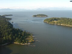
| View from Gabriola Island towards the mainland | ||
|
|
||
| Location: | British Columbia , Canada | |
| Next city: | Sidney | |
| Surface: | 36 km² | |
| Founding: | 2003 | |
| Address: | Gulf-Island National Park of Canada Sidney Operations Center 2220 Harbor Road Sidney, BC Canada V8L 2P6 |
|
| The coast of North Pender Island | ||
The Gulf Islands National Park ( English Gulf Islands National Park Reserve of Canada , French Réserve de parc national du Canada des Îles-Gulf ) is the 40th national park in Canada . It was declared a national park on May 9, 2003 and is located in the province of British Columbia (Western Canada ) with an area of 36 km². It comprises areas on 15 named islands of the Gulf Islands as well as a variety of rocks and reefs . Unlike most other Canadian national parks, it has the addition of reserve . It arises from other rights of use for the local indigenous peoples .
The park was expanded in October 2012 by a total of around 100 hectares on three different islands, the new areas were partly bought by private owners, partly donated by them or transferred from state levels to the federal administration and Parks Canada .
The park is an IUCN Category VI ( Resource Protection Area) protected area .
location
The Gulf Islands National Park is located on the southeast tip of Vancouver Island . The park includes numerous small and tiny islands, on which there is a facility (campground, moorage, picnic area, ...) or several facilities.
Next
- Vancouver Island with
- Gulf Islands National Park Reserve Operations Center
- McDonald Campground
also belong
- Inner Islands with
- Russell Island
- Portland Island (Princess Magaret)
- Brackman Island
- Isle-de-Lis
- Sidney Island
- D'Arcy Island
- Dock Islet, Isabella Islet, Imrie Island, Grieg Island, Reay Island, Littöe Group, Sallas Rock, Unit Rock
- Pender Islands with
- North Pender Island
- South Pender Island
- Blunden Islet
- Prevost Islands with
- Prevost Island
- Channel Island
- Red Islets, Bright Islet, Hawkins Islet
- Outer Islands with
- Saturna Island
- Tumbo Island
- Cabbage Island
- Mayne Island
- Georgeson Island
to the national park.
Web links
- Gulf Islands National Park Reserve , on Parks Canada , (English, French)
- Gulf Islands National Park ( English, French ) In: The Canadian Encyclopedia .
- Réserve de parc national du Canada des Îles-Gulf . In: BC Geographical Names (English)
Individual evidence
- ↑ Parks Canada: Backgrounder: Gulf Islands National Park Reserve ( Memento of the original from October 17, 2013 in the Internet Archive ) Info: The archive link was automatically inserted and not yet checked. Please check the original and archive link according to the instructions and then remove this notice. , Press release from October 12, 2012
- ↑ World Database on Protected Areas - Gulf Islands National Park Reserve of Canada (English)
- ^ Gulf Islands National Park Reserve of Canada. Maps. Parks Canada , accessed October 15, 2012 .


