Hühnerberg (Oberems)
| Chicken Hill | ||
|---|---|---|
|
Chicken Hill |
||
| height | 636 m above sea level NHN | |
| location | near Oberems in the Hochtaunuskreis , Hessen ( Germany ) | |
| Mountains | Taunus | |
| Dominance | 0.5 km → Weilsberg | |
| Coordinates | 50 ° 14 '32 " N , 8 ° 25' 1" E | |
|
|
||
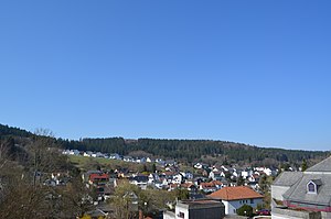
The Hühnerberg in the Glashüttener district of Oberems is a mountain in the Taunus with 636 m above sea level. NHN . It lies on the border between Oberems and the Niederreifenberg district of the Schmitten community in the Hochtaunus district in Hesse .
geography
location
The Hühnerberg forms an elongated ridge on which the border between the communities of Glashütten and Schmitten runs. The mountain has three peaks, of which the middle one is marked in the official maps as the actual chicken mountain. The northern secondary peak Moosheck is 900 m away and has a height of 609 m. The southern secondary peak, 300 m away, is curiously higher than the main peak and extends at this height to about 300 m in length, but there is neither a defined peak nor an altitude in the maps. By interpolating the contour lines, a height of about 655 m can be determined.
The Hühnerberg is part of the ridge that forms the watershed between the Weil in the east and the Emsbach in the west, whose river systems both drain north to the Lahn . The ridge leads south over the Weilsberg to the Kleiner Feldberg and north to the Windhain . The Altstraße known as Hünerstraße runs over the ridge .
Natural allocation
The Hühnerberg belongs in the natural spatial main unit group Taunus (No. 30) and in the main unit Eastern Hintertaunus (302) to the subunit Horse Head Taunus (302.6). Its landscape falls from southwest to west into the subunit Steinfischbacher Hintertaunus (302.7).
See also
Individual evidence
- ↑ a b Map services of the Federal Agency for Nature Conservation ( information )
- ↑ Brigitte Schwenzer: Geographical land survey: The natural space units on sheet 139 Frankfurt a. M. Federal Institute for Regional Studies, Bad Godesberg 1967. → Online map (PDF; 4.9 MB)

