Bamberg harbor
| Bamberg harbor | |||
|---|---|---|---|
| Data | |||
| UN / LOCODE | DE BAM | ||
| owner | Free State of Bavaria | ||
| operator | Bayernhafen GmbH & Co. KG | ||
| opening | 1958 | ||
| Port type | Inland port | ||
| Total area of the port | 96 ha | ||
| Throughput | 270,230 t (2017) | ||
| website | main-donau-hafen.de | ||
| Geographic information | |||
| place | Bamberg | ||
| country | Bavaria | ||
| Country | Germany | ||
| Aerial view of Bamberg harbor | |||
| Coordinates | 49 ° 54 '29 " N , 10 ° 52' 11" E | ||
|
|||
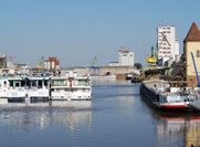
The port of Bamberg consists of two port basins on the Main-Danube Canal in Bamberg and, in addition to the facilities of a freight port, also has a landing stage for river cruise ships.
The total area of the port area is 96 hectares. The port is operated by Bayernhafen GmbH & Co. KG , which operates other inland ports in Bavaria owned by the Free State of Bavaria. The total length of the quays in the two harbor basins is 1900 m. Six port cranes are available. The port's approximately 10 kilometers of track network is connected to the Deutsche Bahn network.
The port of Bamberg functions as a multimodal freight transport center. The focus in the handling of goods is in the area of agricultural products, for example grain or fertilizer . But stones , mineral oil , metal waste, general cargo and containers are also handled.
Around 75 companies from logistics, production, recycling, supply and services use the port as a company location. The operations in the port employ around 1,800 people.
In 2016, the port of Bamberg, with 322,311 t of ship freight traffic, accounted for 4.49% of shipping goods traffic in Bavaria, which in 2016 totaled 7,174,477 t.
history
As early as 1062, Bamberg merchants were mentioned in a document as using the Regnitz-Main waterway. In 1348 a ship loading in Bamberg was mentioned for the first time in the Bamberg legal book and in 1771 a prince-bishop's warehouse ordinance and the construction of a scale were issued. At the beginning of the 19th century (1819) the route investigation for a connecting canal between Main and Danube was completed and shortly afterwards in 1836 a ship connection between Bamberg and Cologne was established. The Bavarian opened after 10 years of construction. King Ludwig I. 1846 the Ludwig-Danube-Main Canal , which begins in Bamberg and ends in Kelheim . At the beginning of the 20th century, the new Prince Ludwig Harbor was built north of the city in 1912 and another Bavarian State Harbor in 1958, which replaced the old city Prince Ludwig Harbor, built in 1912. For this purpose, the Bamberg port administration was set up on May 13, 1958. The inauguration of the port took place on September 25, 1962, at the same time the completion of the Main expansion was celebrated. A short time later in 1966, a total of more than 3,000,000 tons of goods were handled in the newly built port. The port in Bamberg developed more and more into a modern, multimodal freight transport center of supraregional importance. The last baymodal Bamberg's new container terminal was put into operation in 2008.
Cargo handling and passenger traffic
Total cargo handling by mode of transport (in 1000 tons)
| year | ship | train | truck | total |
|---|---|---|---|---|
| 2005 | 450 | 153 | 1760 | 2363 |
| 2006 | 358 | 198 | 1930 | 2486 |
| 2007 | 362 | 121 | 1955 | 2438 |
| 2008 | 338 | 156 | 1935 | 2429 |
| 2009 | 385 | 203 | 1919 | 2507 |
| 2010 | 400 | 293 | 2185 | 2878 |
| 2011 | 296 | 269 | 2221 | 2787 |
| 2012 | 306 | 256 | 2224 | 2786 |
| 2013 | 309 | 279 | 2498 | 3086 |
| 2014 | 342 | 282 | 2566 | 3190 |
| 2015 | 308 | 297 | 2643 | 3248 |
| 2016 | 322 | 310 | 2687 | 3320 |
| 2017 | 270 |
Modal Split 2016:
* Schiff: 9,7 %
* Bahn:    9,3 %
* LKW:    80,9 %
| year | Ships | Passengers |
|---|---|---|
| 2008 | 458 | 66,591 |
| 2009 | 439 | 65,833 |
| 2010 | 451 | 66,516 |
| 2011 | 514 | 76.180 |
| 2012 | 578 | 89.931 |
| 2013 | 553 | 89,000 |
| 2014 | 796 | 130,000 |
| 2015 | 874 | 145.907 |
| 2016 | 854 | 141.291 |
Web links
Individual evidence
- ↑ Cover 2017
- ↑ stadt.bamberg.de
- ↑ landkreis-bamberg.de
- ↑ hdbg.de
- ↑ page 3 (PDF)
- ↑ verkehrsrundschau.de ( page no longer available , search in web archives ) Info: The link was automatically marked as defective. Please check the link according to the instructions and then remove this notice.
- ↑ mainhafen.de
- ↑ Inland navigation in Bavaria in December 2013. (pdf; 527 kB) H21003 201312. In: Statistical Reports. Bavarian State Office for Statistics and Data Processing, March 14, 2014, pp. 15–17 , accessed on March 14, 2014 (German).
- ↑ a b c d Goods handling by barge and rail is increasing, record for hotel ships. (pfd) press releases. bayernhafen Bamberg, June 22, 2015, accessed on January 3, 2016 .


