Haridwar (District)
| Haridwar District हरिद्वार ज़िला |
|
|---|---|

|
|
| State | Uttarakhand |
| Division : | Garhwal |
| Administrative headquarters : | Haridwar |
| Area : | 2360 km² |
| Residents : | 1,890,422 (2011) |
| Population density : | 801 inhabitants / km² |
| Website : | haridwar.nic.in |
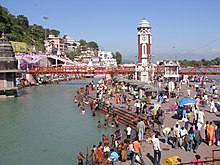
The Haridwar district ( Hindi हरिद्वार ज़िला ) is a district of the Indian state of Uttarakhand . The seat of the district administration is the city of Haridwar .
geography

Haridwar District is located in the Garhwal Division in southwest Uttarakhand. It includes the first mountain range of the Siwaliks and the area of the Ganges plain in front of it . In the north, Haridwar borders the districts of Dehradun and Pauri Garhwal . In the south is the state of Uttar Pradesh . The area of the Haridwar district is 2360 km². Haridwar District is mainly west of the Ganges . The largest city, Haridwar, is where the Ganges breaks through the Siwalik chains. It has 310,562 inhabitants (as of 2011, urban agglomeration). Then comes Roorkee with a population of 273,502. In the northwest of Haridwar is the Rajaji National Park .
population
According to the 2011 census, the Haridwar district has 1,890,422 inhabitants.
Web links
Individual evidence
- ↑ a b Census of India 2011: Primary Census Abstract - Urban Agglomerations / Cities (PDF; 138 kB)
- ↑ Census of India 2011: Primary Census Abstract - Uttarakhand. (PDF; 471 kB)
Coordinates: 29 ° 51 ' N , 77 ° 59' E
