Henrichenburg
|
Henrichenburg
City of Castrop-Rauxel
|
|
|---|---|
| Coordinates: 51 ° 35 ′ 56 " N , 7 ° 18 ′ 45" E | |
| Height : | 57.5 m |
| Area : | 7.37 km² |
| Residents : | 5463 (December 31, 2012) |
| Population density : | 741 inhabitants / km² |
| Incorporation : | 1st January 1975 |
| Postal code : | 44581 |
| Area code : | 02367 |
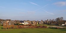
Henrichenburg is the northernmost district of the city of Castrop-Rauxel in North Rhine-Westphalia .
Districts
Historically, the farming communities Borghagen, immediately north of the core town, and Becklem in the far north-west belong to Henrichenburg. In today's urban structure, however, this only plays a subordinate role; the Henrichenburg district is divided by the B 235 into the statistical districts Henrichenburg West (1561 inhabitants) and Henrichenburg East (3902). Today Becklem has the structure of a small settlement, which is separated from the core town by the A 2 and by the Rhine-Herne Canal or the B 235 from the relatively unpopulated Borghagen. The former parts of Borghagen, which are now south of the A2, have grown closer to the core town and are no longer part of Borghagen.
history
The parish of Henrichenburg belonged to Vest Recklinghausen until 1802, when the vest went to the Dukes of Arenberg. In 1811 it came to the Grand Duchy of Berg. In 1815 the vest was incorporated into the Prussian province of Westphalia and in 1816 it became part of the Recklinghausen district . From 1844 Henrichenburg belonged to the Waltrop office .
On January 1, 1975, in the course of local reorganization, the municipality of Henrichenburg was incorporated into the city of Castrop-Rauxel. At the same time it became a town in the Recklinghausen district. At the same time, she moved from the Arnsberg administrative region to the Münster administrative region .
Origin of name
The name of the place is derived from the Henrichenburg , which is no longer preserved and the remains of which were made visible on the outskirts near the Rhine-Herne Canal as part of a landscape park by planting hedges.
coat of arms
Blazon : "In silver (white) a slanting black bar, covered with three golden (yellow) diamonds, each accompanied by a black boat in front and behind."
The municipality of Henrichenburg was awarded a coat of arms in 1937 by the President of Westphalia in Münster. The coat of arms is derived from that of the Lords of Düngelen , who took over Henrichenburg from the Lords of Oer in 1382 . The boats (ships on the upper and lower water levels) symbolize the Henrichenburg ship lift .
Buildings and infrastructure
On November 12, 1938, the first section of the A 2 between Recklinghausen and Gütersloh was opened.
The waterway in the immediate vicinity of Henrichenburg was officially opened as a section (namely the branch canal ) of the Dortmund-Ems canal after seven years of construction on August 11, 1899 by Kaiser Wilhelm II . Reasons for the construction were the relief of the railway, which was no longer able to transport the production of the Ruhr area on its own, as well as the extraction of the Ruhr coal, which experienced competition from English imported coal since the 1880s. Later the section was counted as part of the Rhine-Herne Canal.
The old ship lift was built according to the plans of the Szczecin shipbuilding engineer Rudolph Haack and inaugurated in 1899. It was a key structure of the Dortmund-Ems Canal, because the canal could only be navigated to the port of Dortmund once it was completed . The elevator is the largest and most spectacular structure along the old Dortmund-Ems Canal. It was inaugurated on August 11, 1899 by Kaiser Wilhelm II.
Religious communities
St. Lambertus
The year 1463 found in the old church on Hagenstrasse shows that people have been gathering there for worship since the 15th century. This church was rebuilt and expanded into the parish center Maximilian-Kolbe-Haus between 1970 and 1972 .
In 1902, construction began on today's neo-Gothic St. Lambertus Church based on plans by Wilhelm Sunder-Plaßmann . During the Second World War a bomb destroyed the chancel and towards the end of the war the tower was destroyed. During the later construction work, the spire was not renewed again. Today St. Lambertus is a branch church of the Catholic parish St. Dominikus in Datteln.
Individual evidence
- ↑ History & Impressions of Henrichenburg Castle by Sabine Grimm, page 21 online: [1]
- ↑ Population statistics on December 31, 2012 , City of Castrop-Rauxel (PDF; 60 kB)
- ↑ Geodata Viewer of the city of Castrop-Rauxel ( Memento of the original from January 20, 2013 in the Internet Archive ) Info: The archive link was automatically inserted and not yet checked. Please check the original and archive link according to the instructions and then remove this notice.
- ^ Federal Statistical Office (ed.): Historical municipality directory for the Federal Republic of Germany. Name, border and key number changes in municipalities, counties and administrative districts from May 27, 1970 to December 31, 1982 . W. Kohlhammer, Stuttgart / Mainz 1983, ISBN 3-17-003263-1 , p. 329 .
- ^ Fridolin Beyer: History of the Catholic parish Henrichenburg . In: Vestische Zeitschrift , vol. 30 (1921), pp. 5–37, here p. 8.
- ↑ www.st-lambertus-henrichenburg.de
- ↑ Genealogy Hartmann
Web links
- Henrichenburg in the Westphalia Culture Atlas


