Hienghène
| Hienghène | |
|---|---|

|
|
| province | Northern Province |
| Aire coutumière | Hoot ma waap |
| Coordinates | 20 ° 42 ′ S , 164 ° 55 ′ E |
| height | 0-1,628 m |
| surface | 1,068.80 km 2 |
| Residents | 2,483 (August 26, 2014) |
| Population density | 2 inhabitants / km 2 |
| Post Code | 98815 |
| INSEE code | 98807 |
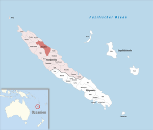
Hienghène is a municipality in the northern province of New Caledonia . It is located in a bay called Hienghène Bay, which is known for its eroded limestone islands.
The islands are remains of a limestone and silica formation that covered the entire bay about 40 million years ago. Erosion from wind and water has eroded the softer limestone and left the harder silica in conspicuous formations. Some of these formations have been given fanciful names, such as the Sphinx, the Towers of Notre Dame and the Hen
The highest point is the Mont Panié with 1629 m.
population
| Population development in Hienghène (2009 estimated) | |||||||||
|---|---|---|---|---|---|---|---|---|---|
| Residents | 1940 | 2109 | 1846 | 1932 | 1729 | 2122 | 2208 | 2627 | 2862 |
| year | 1956 | 1963 | 1969 | 1976 | 1983 | 1989 | 1996 | 2004 | 2009 |
Individual evidence
- ↑ Population development in Hienghène 1956–2009 ( page no longer available , search in web archives ) Info: The link was automatically marked as defective. Please check the link according to the instructions and then remove this notice.