Homburg road
| Homburg road | |
|---|---|
| Street in Frankfurt am Main | |
| Beginning at the Friedberger Warte | |
| Basic data | |
| place | Frankfurt am Main |
| District | Nordend-West , Eckenheim , Preungesheim , Frankfurter Berg , Bonames , Nieder-Eschbach |
| Connecting roads | Ober-Eschbacher Strasse (north) |
| Cross streets | Friedberger Landstrasse , Marbachweg , Gießener Strasse, Jean-Monnet-Strasse, Ben-Gurion-Ring |
| Buildings | Prison Preungesheim, Federal Police , Frankfurter Berg train station |
| Technical specifications | |
| Street length | 8.8 km |
The Homburger Landstrasse is the longest street in Frankfurt and was an important entry and exit road from the north. It leads from the districts of Nordend to Bad Homburg vor der Höhe and crosses the districts of Eckenheim , Preungesheim , Frankfurter Berg , Bonames and Nieder-Eschbach . Its importance today has decreased somewhat with the construction of the A 661 and other bypass roads; in parts it is closed to through traffic.
course
Friedberger waiting
The Homburger Landstrasse begins at the Friedberger Warte as a northwest branch of the Friedberger Landstrasse and there initially forms the borderline between the districts of Nordend-West and Preungesheim. On the eastern side of Preungesheim, around 800 new apartments were built between 2004 and 2008 on the site of the former US housing estate Betts Area , as part of the Walter Kolb estate .
The American Consulate General has been located on the west side in the Nordend-West district since 2005 . The red cross on the roof is evidence of its previous use as a hospital by the US armed forces.
Eckenheim / Preungesheim
To the north of the intersection with Marbachweg , Homburger Landstrasse is again the border road between two urban districts that have grown together structurally. On the east side Preungesheim and on the west side Eckenheim. Here, low terraced houses with small front gardens dominate the streetscape. This is followed by the buildings of the correctional facilities Frankfurt I and Frankfurt III, usually also called JVA Preungesheim . Further north, the development becomes denser, the now narrowed street crosses the old town center of Preungesheim, which was incorporated into Frankfurt in 1910. The baroque Protestant cruciform church goes back to a previous building from the 9th century.
At the Preungesheim subway station , the much wider western parallel street Gießener Straße joins Homburger Landstraße with right of way. The now much more spacious road runs under the federal motorway 661 and shortly afterwards crosses the Jean-Monnet-Straße feeder road . There are supermarkets on the east side of the street, while the Frankfurt Federal Police Office is on the west side . In the coming years, an above-ground subway line to the Frankfurter Berg S-Bahn station is to be built on the wide green strip there.
Frankfurter Berg
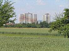
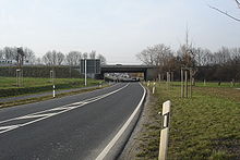
The development flows smoothly into the Frankfurter Berg district . The actual settlement Frankfurter Berg from the 1930s is on the western side of the street. Opposite are housing estates of newer construction, the settlement Berkersheimer Weg . The high-rise buildings at the Julius-Brecht-Straße intersection , which are up to 70 meters high, are visible from afar . At the Main-Weser Railway road swings just before the station Frankfurter Berg , links to the S-Bahn - S6 and future northern terminus of the U5 , to the east and crosses in a wide loop, the three-pronged track area of the station. The historical, straight route is still clearly recognizable from the avenue trees, but the original level crossing has been abandoned today. For pedestrians there is an underpass to platform one of the Frankfurter Berg train station . To the north of the train station, the Homburger Landstrasse leads about one kilometer through undeveloped area. It has retained the character of a country road there . At the end of the 1990s this section was widened and provided with a separate pedestrian and cycle path avenue on both sides and re-established as a double avenue with Kaiserlinden . These Kaiserlinden are offshoots of the trees that line Unter den Linden in Berlin .
As part of the expansion of the Frankfurt-Friedberg railway and S-Bahn line, the bridge on Homburger Landstrasse will be replaced by a new construction in the course of 2020 to 2022.
Bonames
After the Homburg road has crossed the Nidda and passed the Nordpark , it reaches the Bonames district, which has largely retained its rural village character. The narrowness of the street makes it necessary to direct traffic in a northerly direction through the parallel street Alt-Bonames . Taunus foothills also cause the road to climb steeply. At the subway station Bonames Center Homburger country road crosses the barriers secured route of U2 , a transferred to the underground network former small railway of FLAG .
Nieder-Eschbach
The northernmost part of the city on Homburger Landstrasse begins shortly after the subway station and is initially characterized by the Ben-Gurion-Ring settlement . Shortly afterwards, there is an industrial park on the cross street Berner Straße . The northern part of the district is only affected by the Homburger Landstrasse. The Deuil-La-Barre-Straße branches off to the center , which is named after the French twin town Deuil-la-Barre . The last building on Homburger Landstrasse is the Autobahn road maintenance facility on federal autobahn 5 with house number 955.
The street ends at the Frankfurt city limits, near the Bad Homburg Cross, and then continues as Ober-Eschbacher Straße through the Bad Homburg district of Ober-Eschbach .
Web links
swell
- ↑ Stadtvermessungsamt Frankfurt am Main (ed.): Portal GeoInfo Frankfurt , city map
- ↑ frankfurt.de
- ↑ frankfurt.de


