Honnefer Graben
|
Honnefer Graben, Menzenberger Bach (upper course), (Rhine) Breitbacher Graben |
||
|
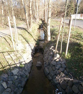
The Honnefer Graben before crossing under Linzer Strasse / Hauptstrasse |
||
| Data | ||
| Water code | DE : 271918 | |
| location | North Rhine-Westphalia | |
| River system | Rhine | |
| Drain over | Rhine → North Sea | |
| source | southeast of the rabbits Hardt 50 ° 37 '38 " N , 7 ° 16' 17" O |
|
| Source height | approx. 292 m above sea level NHN | |
| muzzle | in the Rhine coordinates: 50 ° 37 ′ 24 ″ N , 7 ° 12 ′ 53 ″ E 50 ° 37 ′ 24 ″ N , 7 ° 12 ′ 53 ″ E |
|
| Mouth height | approx. 49 m above sea level NHN | |
| Height difference | approx. 243 m | |
| Bottom slope | approx. 50 ‰ | |
| length | 4.9 km | |
| Catchment area | 4.251 km² | |
| Communities | Bad Honnef , Rheinbreitbach | |
|
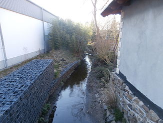
The brook after crossing under Linzer Strasse / Hauptstrasse |
||
The Honnefer Graben (according to the Grenzbach Honnefer Graben river directory ) is a creek that is almost five kilometers long and forms the border between the city of Bad Honnef in the North Rhine-Westphalian Rhein-Sieg district and the local community Rheinbreitbach in the Rhineland-Palatinate district of Neuwied and flows into the Middle Rhine from the right . It bears the river code number 271918, its catchment area is given as 4.251 km².
course
The Honnefer Graben rises southeast of the Hasenhardt ( 305.8 m above sea level ) at about 292 m above sea level. NHN . After a good half a kilometer, it picks up a tributary from the right. After almost two kilometers, it leaves the state and city limits for the first time in a northerly direction to the area of the city of Bad Honnef, then after another half a kilometer, first past the south side of the locality Menzenberg and finally through it, where it flows through the Hagerhof Castle crossed under. After another 300 m it forms the border again, on the south side of which it is accompanied by the Am Honnefer Graben road for a good 700 m . Then it crosses under Linzer Straße (Bad Honnef) or Hauptstraße (Rheinbreitbach) and after just under half a kilometer the street Im Rosenfeld , which acts as a community road between Bad Honnef and Rheinbreitbach . Shortly thereafter, there is a crossing under the Rheinbreitbach junction of Bundesstraße 42 , before which it leaves the border in a southerly direction to the Rheinbreitbach municipality. After crossing under the federal road and the railway line on the right bank of the Rhine , it runs again towards the border, now heading west again. To the east of Heerstrasse it takes up part of the Breitbach, which is diverted here by a ditch . Following the border, the brook flows into the Rhine at Rolandsmühle .
In terms of nature , the upper reaches of the Honnef Graben can be assigned to the Rheinwesterwälder volcanic ridge , and its lower reaches the Honnef valley widening .
history
The brook already formed the southern border of the Auelgau in the Middle Ages , later that between the Duchy of Berg in the north and the Electorate of Cologne in the south. From the Honnefern it was usually (Rhein) Breitbacher Graben , in the upper reaches it is or was also called Menzenberger Bach . The Bad Honnef Indo-Europeanist and Runologe Helmut Arntz assumes that earlier through ditches to the stream of the then existing fourth arm of the Rhine within the so-called. Nuns Werther current division of the river was drained and it resultiere his name. Contrary to this interpretation, the local history researcher Adolf Nekum from Bad Honnef assumes that the stream did not previously have the current course and instead fed the pond at Hagerhof and its overflow then seeped into the Gewann In der Kaulen . Its present-day course, also below Menzenberg, exactly following the border, was given when it was wanted to mark it by creating a ditch to the Rhine. Such land (weir) ditches , including the one between Honnef and Rheinbreitbach, were built in the 16th century by order of the Dukes of Berg to protect their land against foreign invaders. This is why the stream used to be called the Breitbacher Landgraben .
At times, the Honnefer Graben for copper mining in Rheinbreitbach was diverted through a tunnel connection to the water impact for cycling art . The underground course of the brook at Hagerhof Palace was created as part of a comprehensive renovation of the palace complex and the redesign of the associated park between 1865 and 1867.
Web links
Individual evidence
- ↑ a b Topographical Information Management, Cologne District Government, Department GEObasis NRW ( Notes )
- ↑ a b German basic map 1: 5000
- ↑ a b c Water directory of the State Office for Nature, Environment and Consumer Protection NRW 2010 (XLS; 4.67 MB) ( Notes )
- ^ Course of the Honnef trench at OSM
- ↑ a b c d e f g Helmut Arntz (with the assistance of Adolf Nekum): Urkataster und Gewannen: using the example of the community of Honnef 1824/1826 (= Heimat- und Geschichtsverein “Herrschaft Löwenburg” eV : studies on the local history of the city of Bad Honnef on Rhein , Heft 13, Bad Honnef 2000; Society for History of Wine eV : Writings on Wine History , ISSN 0302-0967 , No. 133, Wiesbaden 2000).
- ↑ Heimat- und Geschichtsverein Rhöndorf (ed.); August Haag : Pictures from the past of Honnef and Rhöndorf . Complete production JP Bachem, Cologne 1954, pp. 24, 123.
- ^ Karl Günter Werber : Honnefer walks . 2nd revised edition. Verlag Buchhandlung Werber, Bad Honnef 2002, ISBN 3-8311-2913-4 , p. 83/84 .
- ↑ a b J [ohann] J [oseph] Brungs : The city of Honnef and its history . Publishing house of the St. Sebastianus Schützenverein, Honnef 1925 (reprinted 1978 by Löwenburg-Verlag, Bad Honnef).

