Hopewell Township (Beaver County, Pennsylvania)
| Hopewell Township | ||
|---|---|---|
 Residential area, Gringo, 2014 |
||
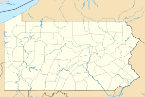
| Location in Pennsylvania | ||
|
|
||
| Basic data | ||
| Foundation : | 1817 | |
| State : | United States | |
| State : | Pennsylvania | |
| County : | Beaver County | |
| Coordinates : | 40 ° 36 ′ N , 80 ° 16 ′ W | |
| Time zone : | Eastern ( UTC − 5 / −4 ) | |
| Residents : | 12,593 (as of 2010) | |
| Population density : | 290.2 inhabitants per km 2 | |
| Area : | 44.01 km 2 (approx. 17 mi 2 ) of which 43.39 km 2 (approx. 17 mi 2 ) is land |
|
| Height : | 357 m | |
| Area code : | +1 724 | |
| FIPS : | 42-007-35640 | |
| GNIS ID : | 1215875 | |
| Website : | www.hopewelltwp.com | |
 Map of Hopewell Township from 1860 |
||
Hopewell Township is a civil parish in Beaver County , Pennsylvania . The suburb is about 30 km from Pittsburgh . In 2010 there were 12,593 people in Hopewell Township.
geography
Large parts of the municipality are used as residential areas with low and medium building density, business and commercial areas are along the main roads . Named locations in the parish are Scottsville, Five Points, and Gringo.
Hopewell Township is on the south bank of the Ohio and encloses the parishes of Aliquippa and South Heights . To the south it is bordered by the townships of Crescent , Moon and Findlay in Allegheny County , to the west by Independence Township and to the north by Raccoon and Center Township . On the opposite side of the river from north to south are Economy , Baden and Ambridge .
history
The Hopewell Township was founded around 1817. The rural community initially developed primarily along Broadhead Road , which connected the forts in what is now Pittsburgh and Beaver . Early centers along the road were the villages of New Sheffield and New Scottsville.
Due to industrialization , in Hopewell Township mainly triggered by the construction of a railroad on the Ohio , oil and gas discoveries and later the steel industry , some villages grew strongly. They left the township and formed new churches. In detail these were:
- 1894 Aliquippa
- 1908 Woodlawn
- 1909 South Heights
- 1926 New Sheffield (incorporated into Woodlawn)
In the middle of the 20th century, the community profited from the urban flight from the surrounding industrial areas.
| Population development | |||
|---|---|---|---|
| Census | Residents | ± in% | |
| 1870 | 1015 | - | |
| 1880 | 1082 | 6.6% | |
| 1890 | 1447 | 33.7% | |
| 1900 | 1346 | -7% | |
| 1910 | 1382 | 2.7% | |
| 1920 | 2123 | 53.6% | |
| 1930 | 2178 | 2.6% | |
| 1940 | 3560 | 63.5% | |
| 1950 | 6644 | 86.6% | |
| 1960 | 13,359 | 101.1% | |
| 1970 | 14,133 | 5.8% | |
| 1980 | 14,662 | 3.7% | |
| 1990 | 13,274 | -9.5% | |
| 2000 | 13,254 | -0.2% | |
| 2010 | 12,593 | -5% | |
Transport and infrastructure
Pennsylvania Route 51 and Interstate 376 run north-south through Hopewell Township .
There are two public elementary schools and two secondary schools in Hopewell Township, Hopewell Memorial Junior High School and Hopewell High School .
Web links
Individual evidence
- ^ Hopewell Township: Official Zoning Map . August 2003 ( hopewelltwp.com [PDF; accessed May 17, 2020]).
- ^ GNIS Detail - Scottsville. Retrieved May 17, 2020 .
- ↑ GNIS Detail - Five Points. Retrieved May 17, 2020 .
- ↑ GNIS Detail - Gringo. Retrieved May 17, 2020 .
- ^ A b History of Beaver County, Pennsylvania . A. Warner & Co., Philadelphia, Chicago 1888, p. 575 (English, archive.org [accessed on May 16, 2020]).
- ^ Clifford J. Smith: Early History of Hopewell Township. In: Hopewell Township, PA. Retrieved May 17, 2020 (English).
- ^ Hopewell Township - Beaver County Historical Research & Landmarks Foundation. Beaver County Historical Research & Landmarks Foundation, accessed May 17, 2020 (American English).
- ↑ Numbers based on census results
- ^ Hopewell Area School District: Schools. Retrieved May 19, 2020 (English).
