Hudson River Park

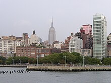
The Hudson River Park is a park on the western shore of Manhattan in New York City . West Village park extends from 59th Street to Battery Park on the Hudson River , along the residential neighborhoods of Clinton , Midtown , Chelsea , Greenwich Village , Tribeca, and Battery Park City . The park covers an area of about 2.2 km² and is the second largest park in Manhattan, after Central Park . It is administered and maintained by the Hudson River Park Trust, a non-profit organization that does not receive any public money for it. All of the foundation's income goes into the maintenance and expansion of the park.
history
The planning for the reconstruction of the waterfront began in 1973. The first planning envisaged the construction of a motorway, the Westway , parallel to the river. To do this, part of the river would have had to be filled in and all existing piers demolished in order to guarantee the route. According to this plan, the park was to be built on part of the backfilled areas. The not inconsiderable resistance to this project finally brought the Westway project to an end in 1985 . The so-called West Side Task Force was set up to further plan the park and presented its final report in 1987. According to this draft, 13 piers were to be preserved and further construction work on the waterfront was heavily regulated. It was decided to create the park so that the waterfront on the Hudson River could be used for recreational purposes.
In 1998 the Hudson River Park Act. Eventually the legal basis for the construction of the park was laid and the Hudson River Park Trust came into being. Construction of the park began in 1999, and Route 9A (12th Avenue) was moved inland. The area was divided into seven segments and the construction was planned by different architects. Some parts of the carriageway were cordoned off even before construction began. The forerunner of the park consisted partly of the old roadway, which was painted with green paint. The New York State and the city have each million 21 dollars invested in the construction of the park.
Attack on October 31, 2017
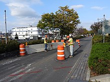
The attack in New York on October 31, 2017 occurred on the Manhattan Waterfront Greenway in Hudson River Park. That day, a man deliberately rode a pickup truck for approximately 1 mile on the park's bike path between Houston Street and Chambers Street , killing eight people and injuring at least eleven. Most of them were cyclists. The incident, believed to be the first deadly terrorist attack in the city of New York since the 9/11 attacks , was committed by a man who allegedly swore allegiance to the Islamic State . Three days after the crime, the park was secured with concrete barricades.
use
The park now consists of footpaths and bike paths parallel to 12th Avenue, as well as green spaces and public piers. The Manhattan Waterfront Greenway , a 51-kilometer pedestrian and bike path around Manhattan, is part of these new paths. There are also various basketball courts, tennis courts, a soccer field, children's playgrounds and dog zones in the park . Some of the remaining piers are also part of the park. Pier 54 includes a skate park and event areas for concerts and similar events. The Chelsea Piers , the largest training and sports center in the city, which includes Piers 59, 60 and 61, is part of the park with its marina .
You can also go canoeing (from Pier 66), rowing boats and sailing boats (from Piers 40 and 66) and kayaking (from Piers 40, 66 and 96) in the park.
panorama
Individual evidence
- ↑ a b Planning and construction of the park ( page no longer available , search in web archives ) Info: The link was automatically marked as defective. Please check the link according to the instructions and then remove this notice.
- ^ Hudson River Park Trust, General Park Information
- ^ History of park planning
- ^ Tragic incident in the Park - Oct 31
- ^ Terrorism suspected after Truck Driver Kills Six in Lower Manhattan
- ^ NYC putting up concrete barriers in wake of terror attack
- ↑ Map of the Manhattan Waterfront Greenway
Coordinates: 40 ° 44 ′ 6 " N , 74 ° 0 ′ 38" W.


