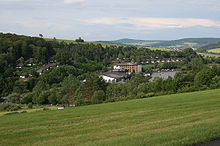
Ibrastausee
| Ibrastausee | |||||||||
|---|---|---|---|---|---|---|---|---|---|
| the reservoir from the air | |||||||||
|
|||||||||
|
|
|||||||||
| Coordinates | 50 ° 49 '5 " N , 9 ° 31' 43" E | ||||||||
| Data on the structure | |||||||||
| Construction time: | 1974 | ||||||||
| Height of the barrier structure : | 7.5 m | ||||||||
| Crown length: | 130 m | ||||||||
| Data on the reservoir | |||||||||
| Water surface | 8.56 hectares | ||||||||
| Reservoir length | approx. 750 m | ||||||||
| Reservoir width | 130 m | ||||||||
| Total storage space : | 400,000 m³ | ||||||||
| Catchment area | 17.114 km² | ||||||||
| Particularities: |
Dam burst on August 22, 1977 |
||||||||
The Ibrastausee , also called Parksee or Seepark Kirchheim , is an 8.56-hectare reservoir on the Ibra in the municipality of Kirchheim in the eastern Hessian district of Hersfeld-Rotenburg , the dam of which was built in 1974 and rebuilt after a break in 1979.
Geographical location
The Ibrastausee is located in the southern foothills of the Knüllgebirge between the Kirchheim districts of Kemmerode in the west-northwest and Reimboldshausen in the east. It is located at the middle course of the Ibra, a tributary of the auditorium .
Reservoir
The Ibrastausee, which lies between the Ibrabach kilometers 4.5 and 3.75, is 8.56 ha in size according to the list of bathing waters in the Fulda / Diemel area . It is 750 m long and 130 m wide. Its capacity is 400,000 m³ and its catchment area is 17.114 km². There is a small island in the reservoir.
dam
General
The barrier structure is a dam with an asphalt concrete outer seal. It is located around the Ibrabach kilometer 3.75 and is around 7.5 m high and 130 m long.
Dam break
On August 22, 1977 at 3:25 p.m. the dam on the lake broke in a storm. The flood storage content of 500,000 m³ of water poured in a tidal wave up to three meters high in the valley of Ibra and Aula, in particular through the villages of Reimboldshausen , Gershausen , Kirchheim , Kleba , Hattenbach and Niederaula to the Fulda .
Several fire brigades, the technical relief organization and other aid organizations were in action. Streets and cellars had to be cleaned of mud. Some cattle drowned, but humans were not harmed. The total damage was thirty million DM .
The railway line of the Knüllwaldbahn near Kirchheim was undermined and damaged by the dam breach in the Ibratal . The section between Niederaula and Oberaula was then permanently shut down.
The fire station of the Gershausen volunteer fire brigade was also destroyed by the tidal wave; it was replaced by a new building in 1980. The dam was rebuilt in 1979.
Seepark Kirchheim
Two years after the dam was built, a holiday complex with a hotel, holiday village and campsite was opened on the north-western bank under the name “Seepark Kirchheim”. The bathing lake has good water quality. As Seepark Kirchheim , the lake is known as a bathing and recreational lake. On the lake, water skiing is operated with the help of a permanently installed system .
See also
Individual evidence
- ↑ a b c d Length of the reservoir (roughly along the center line of the lake) and width measured on the "Map Services ( Memento of December 19, 2012 in the Internet Archive ) of the BfN "
- ↑ a b c d Reservoir and dam breach data according to the information board at the Seepark Hotel
- ↑ a b Water map service of the Hessian Ministry for the Environment, Climate Protection, Agriculture and Consumer Protection ( information )
- ↑ a b master data sheet measuring point standing water s30c Ibrastausee, Seemitte, Kirchheim-Reimboldshausen. In: www3.hlug.de. Retrieved November 8, 2018 .
- ↑ The breach of a dam at Freizeit-See brought horror and devastation , in: Pforzheimer Zeitung of August 24, 1977, p. 7
- ^ Seepark Kirchheim Hessian State Office for Environment and Geology
Web links
- Fire Department Chronicle Heddersdorf
- Gershausen ( Memento from September 14, 2013 in the Internet Archive )
- Seepark Kirchheim ( Memento from January 16, 2014 in the Internet Archive )
- Bathing waters ›Hersfeld-Rotenburg› Seepark Kirchheim Master data Hessian State Office for Environment and Geology


