
Ilse (Lahn)
| Ilse | ||
.JPG) |
||
| Data | ||
| Water code | DE : 258114 | |
| location |
Rothaar Mountains
|
|
| River system | Rhine | |
| Drain over | Lahn → Rhine → North Sea | |
| source | in the Rothaargebirge on the mountains Jagdberg and Kompass 50 ° 53 ′ 8 ″ N , 8 ° 16 ′ 48 ″ E |
|
| Source height | approx. 636 m above sea level NHN ( uppermost Ilsequelle on the Jagdberg) |
|
| muzzle | at Feudingerhütte (district of Feudingen ) in the Lahn coordinates: 50 ° 56 '23 " N , 8 ° 20' 8" E 50 ° 56 '23 " N , 8 ° 20' 8" E |
|
| Mouth height | approx. 382 m above sea level NHN | |
| Height difference | approx. 254 m | |
| Bottom slope | approx. 29 ‰ | |
| length | approx. 8.7 km (from the uppermost Ilsequelle) 8.25 km (from the Heiliger Ilsequelle ) |
|
| Catchment area | 11.848 km² | |
| Left tributaries | see below | |
| Small towns | Bad Laasphe | |
| Location Heilige Ilsequelle ( 608.2 m above sea level ): 50 ° 53 ′ 12 ″ N , 8 ° 17 ′ 10 ″ E |
||
The Ilse is a southern and orographically right tributary of the Lahn in the North Rhine-Westphalian district of Siegen-Wittgenstein ( Germany ). Viewed from the uppermost Ilsequelle , the Ilse is 8.7 km long and from its holy Ilsequelle 8.25 km.
geography
course
The Ilse rises and runs in the south of the Rothaargebirge , Sauerland-Rothaargebirge Nature Park and Westphalia near the central Hessian border from two sources, both of which are located on the border of Wittgenstein and Siegerland near the Bad Laaspher hamlet of Heiligenborn : the uppermost Ilsequelle is on the east-northeast slope of the Jagdberg ( 675.9 m above sea level ) at an altitude of about 636 m , and about 0.5 kilometers downstream from the Ilse river lies the Heilige Ilsequelle on the northwest slope of the Kompass mountain ( 694.1 m ).
The Ilse flows through a narrow valley northeast through the Wittgensteiner Land. After taking in the Langenbach coming from Heiligenborn , which more than doubles its water flow , it passes the Wiedehuck mountains ( 578.6 m ), after which it flows past the hamlet of Lindenfeld ( 496.8 m ; to Bad Laasphe). After passing Inthalberg ( 538.7 m ) and Weidelbacher Haupt ( 587.7 m ) the Weidelbach joins . Then the stream passes the mountains Dörnberg ( 606 m ), Weißer Stein ( 527.6 m ) and Petersberg ( 570 m ).
Finally, the Ilse reaches Feudingerhütte , a district of Feudingen , which belongs to Bad Laasphe , where it flows from the south on the western edge of the village at an altitude of about 382 m into the Rhine tributary Lahn , which flows there from the west .
- Source, course and mouth of the Ilse
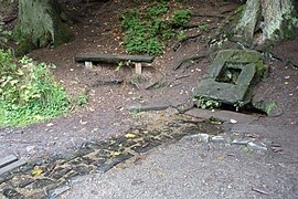
Holy Ilsequelle in the summer of 2013

The Ilse, just below its source, in July 2014

Ilse (from left) at the confluence of the (Schwarzen) Langenbach (2015)


Catchment area and tributaries
The catchment area of the Ilse is 11.848 km². Looking downstream, their tributaries include:
| Surname | page | Length ( km ) |
Mouth | Stat. ( km ) |
EZG ( km² ) |
|---|---|---|---|---|---|
| Langenbach | Left | 3.1 | above the hamlet of Lindenfeld | 6.05 | 2.58 |
| Weidelbach | Left | 2.7 | below the Ilsenburg forest house | 3.45 | 2.183 |
Landscape protection
The Ilse is located with its entire stretch of river in the Bad Laasphe landscape protection area ( CDDA no. 319747), which was designated in 1987 and is 123.11 km² in size.
Traffic and walking
From the confluence of the Langenbach , the district road 17 coming from Heiligenborn leads into the Ilsetal, past the hamlet Lindenfeld and Forsthaus Ilsenburg and then on to Banfe . Below the forester's house, the K 35 branches off from K 17, which leads down the stream along the Ilse to the mouth of the Feudingerhütte .
The Rothaarsteig and the Kleiner Rothaar fairytale hiking trail run right past the Holy Ilsequelle . Through Heiligenborn and from the confluence of the Langenbach, the European long-distance hiking trail E1 leads a few kilometers downstream along the Ilse. The Lahnwanderweg leads through parts of the Ilsetal .
References and comments
- ↑ a b c German basic map (DGK 5) in Topographical Information Management, Cologne District Government, Department GEObasis NRW ( information )
- ↑ a b c d e Water directory of the State Office for Nature, Environment and Consumer Protection NRW 2010 (XLS; 4.67 MB) ( Notes )
- ↑ a b c d e f g Topographical Information Management, Cologne District Government, Department GEObasis NRW ( information )
- ↑ a b and Black Langenbach called
- ↑ Stat. = Water stationing
- ↑ orifice layer (at / near) the tributaries according to the flowing water kilometrage of Ilse
- ↑ Map services of the Federal Agency for Nature Conservation ( information )