Judenkopf (Schmitten)
| Jew head | ||
|---|---|---|
|
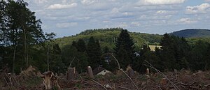
Jews head over Seelenberg, the wind grove seen |
||
| height | 613.8 m above sea level NHN | |
| location | at Schmitten ; Hochtaunuskreis , Hessen ( Germany ) | |
| Mountains | Eastern Hintertaunus ( Taunus ) | |
| Coordinates | 50 ° 15 '59 " N , 8 ° 25' 37" E | |
|
|
||
The Judenkopf near Schmitten in the Hessian Hochtaunuskreis is 613.8 m above sea level. NHN high mountain in the eastern Hintertaunus , part of the German low mountain range Taunus .
Mountain name
The origin of the mountain name is unknown. In the Taunus there is an elevation of the same name near Lorsbach (see also Judenkopf (Lorsbach) ) and a corridor of the same name near Neuenhain , northwest of the settlement of Fuchshöhle am Sulzbach .
geography
location
The Jewish head rises in the Taunus Nature Park . Its summit is 1.3 km west-southwest of Schmitten and 1.2 km (as the crow flies ) northeast of Seelenberg . The Lahn tributary Weil flows southeast past the mountain in a southwest-northeast direction , and the small Niedgesbach tributary Saubach rises in the Sauwiesen to the west and runs in the same direction. North northeastern neighbor is the field header ( 596 m ), the landscape to the north of it contained horse head ( 662.6 m leads over).
Natural allocation
The Jewish head belongs to the natural spatial main unit group Taunus (No. 30) and in the main unit Eastern Hintertaunus (302) to the subunit Pferdskopf-Taunus (302.6).
Protected areas
The nature reserve Saubach and Niedgesbach near Schmitten is located west to north-west of the Judenkopf ( CDDA no. 165327; designated 1995; 64 hectares in size). The fauna-flora-habitat area Niedges-, Sau- and Kirrbachtal also extends there between Mauloff and Schmitten (FFH no. 5716-306; 1.04 km² ).
Jewish cemetery in Schmitten
On the northeast flank of the Judenkopf, about 1 km west of Schmitten, is the Schmitten Jewish cemetery . It was laid out in 1820 and the last burial took place around 1935.
Traffic and walking
State road 3023 runs above the Weil between Schmitten and Seelenberg, especially over the south and south-west flank of the Judenkopf. For example, starting on this road, the mountain can be hiked on forest paths and paths.
See also
Individual evidence
- ↑ a b c Map services of the Federal Agency for Nature Conservation ( information )
- ↑ Barbara Rösch: Der Judenweg: Jewish history and cultural history from the perspective of field name research, 2009, ISBN 9783647569987 , p. 305, online
- ↑ https://www.lagis-hessen.de/de/subjects/xsrec/id/520823/current/355/pageSize/50/page/8/sn/fln?q=YToxOntzOjg6ImdlbWVpbmRlIjtzOjI2OiI0MzYwMDE6QtcyFZhuDWNv====


