Jurjusan (river)
|
Jurjusan Юрюзань, Йүрүҙән |
||
|
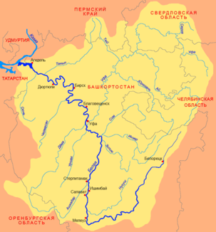
Location of Jurjusan (Юрюзань) in the catchment area of the Belaya |
||
| Data | ||
| Water code | RU : 10010201112111100023101 | |
| location | Chelyabinsk Oblast , Bashkortostan ( Russia ) | |
| River system | Volga | |
| Drain over | Ufa → Belaya → Kama → Volga → Caspian Sea | |
| source |
Jamantau , southern Urals 54 ° 17 ′ 39 ″ N , 58 ° 14 ′ 28 ″ E |
|
| Source height | approx. 960 m | |
| muzzle |
Pavlovsky reservoir at Karaidel coordinates: 55 ° 42 '20 " N , 56 ° 58' 15" O 55 ° 42 '20 " N , 56 ° 58' 15" O |
|
| Mouth height | approx. 140 m | |
| Height difference | approx. 820 m | |
| Bottom slope | approx. 2 ‰ | |
| length | 404 km | |
| Catchment area | 7240 km² | |
| Drain |
MQ |
55 m³ / s |
| Left tributaries | Kutkurka , Kataw | |
| Right tributaries | Beresjak , Minka , Koschelewka | |
| Reservoirs flowed through | Pavlovsk reservoir | |
| Medium-sized cities | Trjochgorny , Ust-Kataw | |
| Small towns | Jurjusan , Jangan-Tau | |
| Navigable | on the lower 10 km | |
|
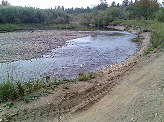
Jurjusan at Ust-Kataw |
||
|
Jurjusan in Ust-Kataw |
||
The Jurjusan ( Russian Юрюзань ; Bashkir Йүрүҙән ) is a left tributary of the Ufa (and thus part of the Volga system) in the European part of Russia .
The name translates as "great valley" or "great canal" and comes from the Bashkir language .
course
The Jurjusan rises in the southern Urals on the northeast slope of the 1,640 m high Yamantau in the east of the Republic of Bashkortostan , not far from the border with Chelyabinsk Oblast . From there it first flows northeast and after around 10 km reaches the Chelyabinsk Oblast. Here he picks up the Beresjak , and shortly afterwards turns west.
After the confluence of the Kutkurka , the river turns north again and after a few kilometers reaches the closed town of Trjochgorny and the small town of Jurjusan, which is only a little to the north . Then the river flows again to the west, where the Kataw joins at Ust-Kataw .
About 5 km west of Ust-Kataw the Jurjusan reaches the border to Bashkortostan again. It turns north again and, with a few short interruptions, now marks the border between Bashkortostan and Chelyabinsk Oblast for several kilometers. About 10 km south of the regionally known health resort Jangan-Tau , it then finally flows to Bashkortostan.
The Jurjusan now flows through the north-east of Bashkortostan in a curvy mainly north-westerly direction, before it reaches the Pavlovsk reservoir near Karaidel and flows over this into the Ufa.
use
Because of its scenic surroundings, the river is used a lot by water sports enthusiasts, including rafting and canoeing trips. The river freezes between the second half of October and the beginning of December and the ice breaks in April. During the ice-free time, the river is navigable for the lower 10 km. In addition, the water from Jurjusan is used as industrial water in industry.


