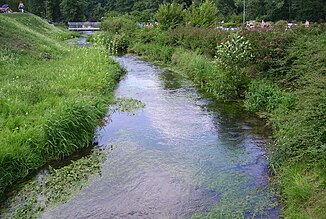
Kainach (Wiesent)
|
Kainach left main line upper course: Schwalbach |
||
|
Kainach in the Hollfeld swimming pool |
||
| Data | ||
| Water code | DE : 242612 | |
| location |
Franconian Alb
|
|
| River system | Rhine | |
| Drain over | Wiesent → Regnitz → Main → Rhine → North Sea | |
| origin | Confluence of the left Schwalbach and right Kaiserbach in Hollfeld- Kainach 49 ° 57 ′ 30 ″ N , 11 ° 17 ′ 20 ″ E |
|
| Source height | approx. 395 m above sea level NHN | |
| muzzle | in Hollfeld next to the river bridge on Forchheimer Straße from the left and north into the upper Wiesent Coordinates: 49 ° 56 '8 " N , 11 ° 17' 25" E 49 ° 56 '8 " N , 11 ° 17' 25" E |
|
| Mouth height | approx. 379 m above sea level NHN | |
| Height difference | approx. 16 m | |
| Bottom slope | approx. 1.2 ‰ | |
| length | 13 km with Schwalbach | |
| Catchment area | 60.47 km² | |
The Kainach is a 4 km long stream in the Bayreuth district in Bavaria , which flows into the upper Wiesent from the left and north in the town of Hollfeld . Together with its Schwalbach upper course up to its origin in the Kainach district , it reaches a length of about 13 km.
course
The Kainach arises from the confluence of the left, Schwalbach coming from the north-northeast and the shorter Kaiserbach in Kainach, approaching from the north-northwest . Their upper valleys, especially that of the Kaiserbach, lead to water far below. From Kainach on, the Kainach moves in a winding meander in its Kerbsohlental, which is lined with forest on the slopes, southwards, without taking in any larger tributaries. In the center of Hollfeld it turns for just a short lower section to the southwest and then flows into the upper Wiesent next to the bridge of Forchheimer Straße (St 2189) about 4.0 km below its confluence from the left .
Along with the Schwalbach is the Kainach about 13.0 km long, at least if one of these their highest source at junction Schirradorf the A 80 expects to; on the first one and a half kilometers next to the autobahn route through the Fuchsteichtal, a side valley of the much longer dry valley from Heidelknock in the north, up to a little before Wonsees- Schirradorf, this often does not have any water.
Catchment area
The 60.5 km² catchment area of the Kainach is located in Franconian Switzerland in the northern Franconian Jura . It borders in the north-west on that of the Weismain , in the north-east on that of the Friesenbach ; in the southeast the Erbach, which flows into the Lochau , as well as this itself drain the area beyond the watershed to the Wiesent below, in the southwest the Wiesent, which flows very close to the Kainach and absorbs it. The highest elevation Heidelknock ( 537 m above sea level ) is on the northern tip at Kasendorf -Zultendorf in the neighboring district of Kulmbach , which includes a large part of the upper catchment area.
The catchment area is characterized by the heavily karstified Upper Jurassic limestone underground and therefore shows long, completely waterless upper valleys; Shortly before Hollfeld is the geotope Käthelesteinhöhle , a half-cave with a rock gate . The valley of the Kainach itself and that of its main upper course, the Schwalbach, are located in the Franconian Switzerland-Veldenstein Forest Nature Park and mostly in the Franconian Switzerland-Veldenstein Forest nature reserve.
places
The Kainach flows through the following places:
See also
Individual evidence
BayernAtlas ("BA")
Official online waterway map with a suitable section and the layers used here: Course and catchment area of the Kainach from Hollfeld
General introduction without default settings and layers: BayernAtlas of the Bavarian State Government ( notes )
- ↑ a b c Height requested on the background layer Official map (right click).
- ↑ Length measured on the official map background layer .
- ↑ Geology according to the layer geological map 1: 500,000 .
Water directory Bavaria ("GV")
- ↑ Length according to: Directory of stream and river areas in Bavaria - Main river area, page 53 of the Bavarian State Office for the Environment, as of 2016 (PDF; 3.3 MB)
- ↑ Catchment area according to: Directory of brook and river areas in Bavaria - Main river area, page 53 of the Bavarian State Office for the Environment, as of 2016 (PDF; 3.3 MB)
Others
literature
- Official topographic map (ATK) 1: 25,000 No. D10 Hollfeld of the State Office for Digitization, Broadband and Surveying Bavaria
Web links
- Map of the course of the Kainach on: BayernAtlas of the Bavarian State Government ( information )
- Map of the Kainach catchment area on: Map service water management, FGN Bavarian State Office for the Environment ( information )
