Lochau (Truppach)
| Lochau | ||
|
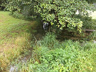
The Lochau (flowing from the front left to the back) is reinforced by the brook from the Weihersbrunnen (from the right) |
||
| Data | ||
| Water code | DE : 242626 | |
| location |
Franconian Switzerland
|
|
| River system | Rhine | |
| Drain over | Truppach → Wiesent → Regnitz → Main → Rhine → North Sea | |
| source | east of Lochau 49 ° 57 ′ 54 ″ N , 11 ° 25 ′ 14 ″ E |
|
| Source height | approx. 510 m above sea level NHN | |
| muzzle | in Plankenfels in the Truppach coordinates: 49 ° 53 '6 " N , 11 ° 20' 39" E 49 ° 53 '6 " N , 11 ° 20' 39" E |
|
| Mouth height | approx. 363 m above sea level NHN | |
| Height difference | approx. 147 m | |
| Bottom slope | approx. 8.6 ‰ | |
| length | 17.1 km | |
| Catchment area | 41.65 km² | |
The Lochau is a right tributary of the Truppach in Franconian Switzerland in Upper Franconia .
geography
course
The Lochau rises east of Lochau . It flows through the town in a westerly direction, takes up the book moat and bends to the southwest. Before Alladorf , the Lochau is reinforced by the significantly larger outflow of the Weihersbrunnen . It continues through the villages of Trumsdorf , Schönfeld and Wohnsdorf. The Lochau flows into the Truppach in the Hammer district of Plankenfels .
Tributaries
- Book moat (right)
- (Outflow of the pond fountain ) (right)
- (Outflow of the hunter fountain ) (left)
- Erbach (right)
See also
literature
- Johann Kaspar Bundschuh : Lochau . In: Geographical Statistical-Topographical Lexicon of Franconia . tape 3 : I-Ne . Verlag der Stettinische Buchhandlung, Ulm 1801, DNB 790364301 , OCLC 833753092 , Sp. 384-385 ( digitized version ).
- Erich Freiherr von Guttenberg : Land and city district of Kulmbach (= historical book of place names of Bavaria, Upper Franconia . Volume 1 ). Commission for Bavarian State History, Munich 1952, DNB 451738918 , p. 100 .
Web links
Commons : Lochau - collection of images, videos and audio files
Individual evidence
- ↑ a b BayernAtlas of the Bavarian State Government ( notes )
- ↑ a b List of brook and river areas in Bavaria - Main river area, page 63 of the Bavarian State Office for the Environment, as of 2016 (PDF; 3.3 MB)

Look to the valley of Lochau from Postal Plankenstein from
