Kalbach (Nidda)
| Kalbach | ||
|
Map of the catchment area of the Kalbach |
||
| Data | ||
| Water code | DE : 248932 | |
| location |
Rhine-Main lowlands
|
|
| River system | Rhine | |
| Drain over | Nidda → Main → Rhine → North Sea | |
| source | southeast of Bommersheim 50 ° 11 ′ 55 ″ N , 8 ° 36 ′ 18 ″ E |
|
| Source height | 177 m above sea level NHN | |
| muzzle | near Frankfurt-Bonames in the Nidda coordinates: 50 ° 10 '36 " N , 8 ° 39' 50" E 50 ° 10 '36 " N , 8 ° 39' 50" E |
|
| Mouth height | 101 m above sea level NHN | |
| Height difference | 76 m | |
| Bottom slope | 14 ‰ | |
| length | 5.3 km | |
| Catchment area | 9.76 km² | |
|
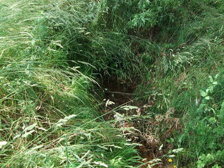
The Kalbachquelle south of Bommersheim |
||
|
The Kalbach flows south of Frankfurt-Bonames into a right arm of the Nidda |
||
|
Retention basin near Bommersheim |
||
The Kalbach is a 5.4 km long right and northern tributary of the Nidda in Hesse . The stream rises near the town of Oberursel . 3.6 kilometers of the further course of the stream including its mouth are in the urban area of Frankfurt am Main .
geography
course
The Kalbach rises near Oberursel- Bommersheim on the southern slope of the Taunus low mountain range . The direction of flow of the water from the source to the mouth is predominantly from northwest to southeast. In Bommersheim a few hundred meters of the course of the stream are piped. Behind Bommersheim, after almost three kilometers of flow through agricultural areas, it enters the Frankfurt urban area northeast of the Frankfurt-Kalbach-Riedberg district - when crossing under the federal motorway 5 .
The stream flows through the historical core of the village of Kalbach. About 750 meters east of the village flows the Kalbach from the right as its largest tributary, the Kätcheslach to - a trench, which the drainage of sealed areas in the Ried mountain settlement used (→ Kätcheslachpark ) . The Kalbach then runs between the southwestern edges of the built-up areas of Kalbach and Frankfurt-Bonames and other areas used for agriculture and horticulture. There he is accompanied for the route of around one kilometer by the regional Hölderlin path hiking trail .
After passing under the A 661 from the northwest of Bach reached the conservation area of the Frankfurt green belt . There part of the water is diverted to feed the wetland at the old Bonames airfield . Shortly before its mouth, the Kalbach has another tributary, the Black Kalbach . South of Bonames ends of Kalbach finally in a by renaturation connected -measures back to the river Nidda Bonameser bayou .
Nidda river system
Localities
The localities on the Kalbach include (viewed downstream):
- Oberusel - Bommersheim (Hesse)
- Frankfurt-Kalbach (Hesse)
- Frankfurt-Bonames (Hesse)
literature
- City of Frankfurt am Main, Umweltamt (Ed.): Stadtgewässer - Discover rivers, brooks, oxbow lakes, Frankfurt 2004. Therein: Kapitel Kalbach, p. 71
- City of Frankfurt am Main, Environment Agency (Ed.): The Green Belt Leisure Card . 7th edition, 2011
Web links
- Kalbach on the HP city of Frankfurt
- Cadastre of existing retention areas State of Hesse: Kalbach (PDF file, 896 kB; accessed on September 22, 2015)
Individual evidence
- ^ Author of the graphic: City of Frankfurt am Main, Environment Agency. Reproduction used under the conditions of § 59 UrhG (freedom of panorama). See the description page for the file on Wikimedia Commons
- ↑ Water map service of the Hessian Ministry for the Environment, Climate Protection, Agriculture and Consumer Protection ( information )
- ↑ Cadastre of existing retention areas State of Hessen: Kalbach ( page no longer available , search in web archives ) Info: The link was automatically marked as defective. Please check the link according to the instructions and then remove this notice.
- ↑ a b c d City of Frankfurt am Main, Umweltamt (Ed.): Stadtgewässer, p. 71
- ^ City of Frankfurt am Main, Environment Agency (ed.): The green belt leisure map . 7th edition, 2011
![Map of the catchment area of the Kalbach [1]](https://upload.wikimedia.org/wikipedia/commons/thumb/2/20/FFM_Kalbach_%28Nidda%29_Einzugsgebiet-Grafiken_FoP.de.jpg/326px-FFM_Kalbach_%28Nidda%29_Einzugsgebiet-Grafiken_FoP.de.jpg)


