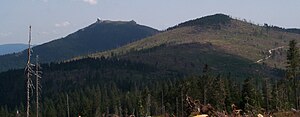
Little Arber
| Little Arber | ||
|---|---|---|
|
Right the Little Arber, left the Big Arber |
||
| height | 1383.6 m above sea level NHN | |
| location | Bavaria , Germany | |
| Mountains | Bavarian forest | |
| Dominance | 1.5 km → Großer Arber | |
| Notch height | 113 m ↓ Chamer hut | |
| Coordinates | 49 ° 6 '48 " N , 13 ° 6' 35" E | |
|
|
||
| rock | Gneiss | |
The Kleine Arber in the Bavarian Forest is 1383.6 m above sea level. NHN the highest mountain in the Upper Palatinate . The border with Lower Bavaria runs over its summit and over that of the Großer Arber to the east ( 1455.5 m above sea level ; a rock bar west of the summit cross with 1439.6 m represents the highest point in the Upper Palatinate).
On the rocky summit there is a stately wooden cross with a summit book, the view extends over the Lamer Winkel to the Zellertal .
geography
The summit of the Kleiner Arber lies in the municipal areas of Lohberg in the north in the Upper Palatinate district of Cham and in the south of Bodenmais in the Lower Bavarian district of Regen .
useful information
Many hiking trails lead on the Kleine Arber, including from Bodenmais, the Kleiner Arbersee or from Schareben , and the European long-distance hiking trail E6 runs from Kaitersberg to Falkenstein over the summit.
To the east, just below the summit, lies the Chamer Hut. It was built in 1952 by the Cham section of the Bavarian Forest Association and then operated as a restaurant. In 1956 she took over the German Youth Hostel Association and expanded it into a youth hostel. Not managed since 1999, it was reopened as a mountain hut on December 20, 2008 .
Individual evidence
Web links
gallery
The Small Arber of Bärnzell seen from


