
Klikuszowa
| Klikuszowa | |||
|---|---|---|---|
 Help on coat of arms |
|
||
| Basic data | |||
| State : | Poland | ||
| Voivodeship : | Lesser Poland | ||
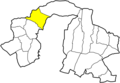
| Powiat : | Nowy Targ | ||
| Gmina : | Nowy Targ | ||
| Geographic location : | 49 ° 31 ' N , 19 ° 59' E | ||
| Residents : | 1470 (2004) | ||
| Telephone code : | (+48) 18 | ||
| License plate : | KNT | ||

Klikuszowa is a village with a Schulzenamt of the Nowy Targ municipality in the Nowotarski powiat of the Lesser Poland Voivodeship in Poland .
geography
The place is on the brook Lepietnica under the Gorcen .
Village in the parish

history
The place was first mentioned in 1389 as a village founded a little earlier under German law on an old trade route to Hungary. The inhabitants were mostly shepherds.
During the first partition of Poland in 1772 the village became part of the new Kingdom of Galicia and Lodomeria of the Habsburg Empire (from 1804).
In 1918, after the end of the First World War and the collapse of the Austro-Hungarian monarchy, Klikuszowa came to Poland. This was only interrupted by the occupation of Poland by the Wehrmacht in World War II .
From 1975 to 1998 Klikuszowa was part of the Nowy Sącz Voivodeship .

Place view

church


Web links
Individual evidence
- ^ Joint work: Gorce. Przewodnik dla prawdziwego turysty . Oficyna Wydawnicza "Rewasz", Pruszków 2004, ISBN 83-8918819-8 , p. 275 (Polish).
- ↑ Dz.U. 1975 no 17 poz. 92 (Polish) (PDF file; 783 kB)
