
Pyzówka
| Pyzówka | |||
|---|---|---|---|
 Help on coat of arms |
|
||
| Basic data | |||
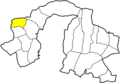
| State : | Poland | ||
| Voivodeship : | Lesser Poland | ||
| Powiat : | Nowy Targ | ||
| Gmina : | Nowy Targ | ||
| Geographic location : | 49 ° 31 ' N , 19 ° 56' E | ||
| Residents : | 901 (2004) | ||
| Postal code : | 34-404 | ||
| Telephone code : | (+48) 18 | ||
| License plate : | KNT | ||
| Economy and Transport | |||
| Rail route : | Chabówka – Zakopane | ||


Pyzówka is a village with a Schulzenamt of the Nowy Targ municipality in the Nowotarski powiat of the Lesser Poland Voivodeship in Poland .
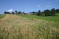
geography
The place is in so-called Podhale .
Village in the parish
Hamlet of Grapa


history
The place was founded by Jan Pieniążek at the turn of the 16th century. It belonged to the Starostei in Nowy Targ until the partitions of Poland .
When Poland was first partitioned in 1772, the village became part of the new Kingdom of Galicia and Lodomeria of the Habsburg Empire (from 1804). At that time it belonged to the Stadnicki family with Klikuszowa .
In 1918, after the end of the First World War and the collapse of the Austro-Hungarian monarchy, Pyzówka came to Poland. This was only interrupted by the occupation of Poland by the Wehrmacht in World War II .
From 1975 to 1998 Pyzówka was part of the Nowy Sącz Voivodeship .
In 1984 the Roman Catholic parish was established (formerly it belonged to the parish in Klikuszowa).
Web links
Individual evidence
- ^ A b Stanisław Figiel, Urszula Janicka-Krzywda, Piotr Krzywda, Wojciech W. Wiśniewski: Beskid Suski. Przewodnik . Oficyna Wydawnicza "Rewasz", Pruszków 2006, ISBN 83-8918859-7 , p. 387 (Polish).
- ↑ Dz.U. 1975 no 17 poz. 92 (Polish) (PDF file; 783 kB)
