Várpalota district
| circle Várpalotai járás
Várpalota |
|
|---|---|
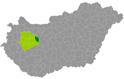
 Location of the district in Hungary |
|
| Basic data | |
| Country | Hungary |
| County | Veszprém |
| Seat | Várpalota |
| surface | 294.3 km² |
| Residents | 36,420 (January 1, 2016) |
| density | 124 inhabitants per km² |
Várpalota ( Hungarian Várpalotai járás ) is a district in the east of the Hungarian Veszprém county . It borders in the south on the Balatonalmádi district , in the west on the Veszprém and Zirc districts . In the northeast forming circle Mór and east of the county Székesfehérvár (both Fejér county ) the Komitatsgrenzen.
history
At the beginning of 2013, in the course of the Hungarian administrative reform, all seven municipalities from the small area Várpalota (Hungarian Várpalotai kistérség ) were taken over into the successor group of the same name. The circle was strengthened by a municipality from the small area Veszprém .
Community overview
The Várpalota County has an average municipality size of 4,553 inhabitants on an area of 36.78 square kilometers. The population density is the second highest in the county. The district seat is located in the largest city, Várpalota , almost in the middle of the circle.
| Communities | status | Origin small area |
population | Area (km²) | Population density (inh / km²) |
||
|---|---|---|---|---|---|---|---|
| October 01, 2011 | 01/01/2013 | 01/01/2016 | |||||
| Berhida | city | Várpalota | 5,839 | 5,917 | 5,785 | 42.72 | 135.4 |
| Jásd | local community | Várpalota | 722 | 717 | 700 | 10.28 | 68.1 |
| Ősi | local community | Várpalota | 2,067 | 2,065 | 1,984 | 35.86 | 55.3 |
| Öskü | local community | Várpalota | 2,254 | 2,230 | 2,195 | 48.30 | 45.4 |
| Pétfürdő | Large community | Várpalota | 4,768 | 4,775 | 4,752 | 17.32 | 274.4 |
| Tés | local community | Várpalota | 844 | 803 | 767 | 49.03 | 15.6 |
| Várpalota | city | Várpalota | 20,756 | 20,307 | 19,640 | 77.26 | 254.2 |
| Vilonya | local community | Veszprém | 632 | 637 | 597 | 13.50 | 44.2 |
| Várpalota district | 37,882 | 37,451 | 36,420 | 294.27 | 123.8 | ||
swell
PDF and XLS files: 2011
Census :
2013:; 2016:
Individual evidence
- ↑ KSH: 2011. Évi Népszámlálás. In: 3. Területi adatok. KSH, accessed on December 30, 2016 (Hungarian, also via: http://www.terezvaros.hu/testuleti/nepsz2011-3/pdf/nepsz2011_03_19.pdf ).
- ↑ KSH: Regional data - Veszprém county. KSH, accessed December 30, 2016 (English, 4th Data on Localities).
- ↑ KSH: Gazetteer of Hungary, 1st January, 2013. KSH, accessed April 7, 2017 (Hungarian / English).
- ↑ KSH: Gazetteer of Hungary, 1st January, 2016. KSH, accessed April 7, 2017 (Hungarian / English).