Lalitpur (Nepal)
| Lalitpur Upmahanagarpalika लालितपुर उपमहानगरपालिका Lalitpur |
||
|---|---|---|
|
|
||
| Coordinates | 27 ° 40 ′ 0 ″ N , 85 ° 19 ′ 0 ″ E | |
| Basic data | ||
| Country | Nepal | |
| Bagmati | ||
| District | Lalitpur | |
| ISO 3166-2 | NP-P3 | |
| height | 1350 m | |
| surface | 24.9 km² | |
| Residents | 254,308 (2011) | |
| density | 10,213.2 Ew. / km² | |
| Website | www.lalitpur.org.np | |
| City law 2nd order 30 wards |
||
|
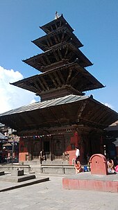
Patan, Durbar Square , 2002
|
||
Lalitpur ( Nepali : लालितपुर Lālitpur ) or Patan (पाटन Pāṭan ), Newari Yala (official name: Lalitpur Sub-Metropolitan City ) is the third largest city in Nepal , after Kathmandu and Pokhara .
Lalitpur is located in the Kathmandu valley on the south bank of the Bagmati in the Lalitpur district and forms a twin city with Kathmandu . By incorporating the neighboring Village Development Committees (VDCs) Dhapakhel , Harisiddhi and Sunakothi , the urban area grew from 15.43 km² to 24.9 km².
Residents
Around the year 1000 it was the tenth largest city in the world with around 100,000 inhabitants. In 2011 the city had 220,802 inhabitants. With the three incorporated VDCs, the population in 2011 was 254,308 (130,556 male) in 62,893 households.
geography
climate
|
Monthly average temperatures and rainfall for Lalitpur Patan
|
||||||||||||||||||||||||||||||||||||||||||||||||||||||||||||
history
The history of the city goes back more than 2300 years. According to tradition, the city is the oldest in the Kathmandu valley and was founded in the 3rd century BC. Founded by the Kirat dynasty. For many centuries Lalitpur was the capital of its own kingdom, which was only incorporated into the Kingdom of Nepal under King Prithvi Narayan Shah in 1768. Originally the city and kingdom were called Patan .
2015 earthquake
A major earthquake on April 25, 2015 damaged or destroyed numerous buildings in the city, including the buildings in the central Durbar Square, which is part of the “Kathmandu Valley” UNESCO World Heritage Site .
Population development
The following table shows the development of the population of the city of Lalitpur.
|
Attractions
- Patan Durbar Square
- Hiranya Varna Mahaa Vihar, the Temple of a Thousand Buddhas
- Kumbeshwar Temple, a five-story pagoda
- Zoo, opened in 1932, is the only one in Nepal
Infrastructure
Hospitals
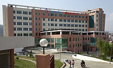
The private hospital Nepal Mediciti is one of the leading hospitals in South Asia.
The Patan Hospital is the teaching hospital for the Patan Academy of Health Sciences.
Web links
- Kathmandu Valley on the UNESCO World Heritage Center website ( English and French ).
- The official site of the city
Individual evidence
- ↑ General Bureau of Statistics, Kathmandu, Nepal, Nov. 2012
- ↑ Municipal Association of Nepal (MuAN) ( Memento of the original from January 7, 2014 in the Internet Archive ) Info: The archive link was inserted automatically and has not yet been checked. Please check the original and archive link according to the instructions and then remove this notice.
- ↑ National Population and Housing Census 2011 (PDF; 2.1 MB) Central Bureau of Statistics. Archived from the original on July 31, 2013.
- ↑ Earthquake in Nepal: Patan Durbar Square shattered completely , india.com, accessed April 27, 2015.
- ↑ Pravakar Pradhan and Ranjith Perera (2005): Urban Growth and Its Impact on the Livelihoods of Kathmandu Valley, Nepal . UMP-Asia Occasional Paper No. 63, p. 14 ( PDF, 1.9 MB ( Memento from April 12, 2006 in the Internet Archive )).


