Lambaré
| Lambaré Lambare |
|
|---|---|
|
Coordinates: 25 ° 20 ′ S , 57 ° 38 ′ W
Lambaré
Lambare on the map of Paraguay |
|
| Basic data | |
| Country | Paraguay |
| Department | Central |
| City foundation | 1766 |
| Residents | 119,795 (2002) |
| Detailed data | |
| surface | 37 km 2 |
| Population density | 3,238 inhabitants / km 2 |
| height | 47 m |
| Time zone | UTC −4 |
| Website | |
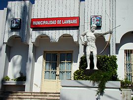
Lambaré ( Guaraní Ambare , Land of Shadows , Spanish El Ambare , or after the chief Avambare) is a city in the Central Department in the metropolitan region of Paraguay's capital, Asunción, with over 200,000 inhabitants (2016) and the capital of the Lambaré district of the same name.
Lambaré is located in the south of Asunción on the Paraguay River and thus only 3 km from the Argentine border.
One of the sights is the Cerro Lambaré: The highest point in the Asunción region is on the city limits between Asunción and Lambaré, 12 km from the center of Asunción. You have a view over the city. There is a stele on top of the Cerro Lambaré. The Cacique Lambaré and President Alfredo Stroessner were immortalized larger than life around this stele . In 1989, with Stroessner's fall, his statue was also removed. The Cerro Lambaré is easy to reach via the access road.
Web links
Individual evidence

