
Limpio
| Limpio | |
|---|---|
|
Coordinates: 25 ° 10 ′ S , 57 ° 30 ′ W
Limpio on the map of Paraguay
|
|
| Basic data | |
| Country | Paraguay |
| Department | Central |
| City foundation | February 1, 1785 |
| Residents | 136.323 (S 2018) |
| Detailed data | |
| surface | 117 km 2 |
| Population density | 1,165 inhabitants / km 2 |
| Post Code | 2020 |
| prefix | (595) (291) |
| Time zone | UTC −4 |
 |
|

Limpio is a city and a district in Paraguay in the north of the Central Department with 141,000 inhabitants.
The city was founded in 1785 by the Franciscan Luis de Bolaños under the name San José de los Campos Limpios de Tapúa . It was one of the first places of mesticism between Spaniards and the Guaraní .
She is known for making hats and bags from palm leaves of Trithrinax brasiliensis , commonly known as Caranday .
description
The city is considered to be one of the first inhabited places in the country. It has an extension of about 117 km² and is divided into 9 compañías and 20 barrios, urbanizaciones and villages. Some areas still seem completely rural, others show increasing urban dynamism.
The city is bordered by two major rivers: the Paraguay River to the west and the Salado River to the east. It is located 23 km north of the state capital Asunción .
The city has a port on the Paraguay River called Piquete Cué . The Limpio district is a center of immigration from the capital region because of the infrastructure it offers.
gallery
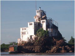
Limpio rock island in the Paraguay River
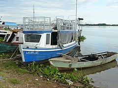
Piquete Cué

Church in Limpio

church Square
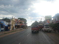
Street in Limpio


Web links
Individual evidence
- ↑ Cities & Towns citypopulation.de , 2018, accessed December 6, 2018.
- ↑ Ciudad de Limpio centralnoticias.com.py , accessed on 6 December 2018th
Areguá | Capiatá | Fernando de la Mora | Guarambaré | Itá | Itauguá | Juan Augusto Saldívar | Lambaré | Limpio | Luque | Mariano Roque Alonso | Ñemby | Nueva Italia | San Antonio | San Lorenzo | Villa Elisa | Villeta | Ypacaraí | Ypané